Home>Articles>What Weather Instrument Is Used To Measure Precipitation
Articles
What Weather Instrument Is Used To Measure Precipitation
Modified: January 5, 2024
Learn about the various articles used as weather instruments to accurately measure precipitation.
(Many of the links in this article redirect to a specific reviewed product. Your purchase of these products through affiliate links helps to generate commission for Storables.com, at no extra cost. Learn more)
Introduction
Precipitation is a vital aspect of the Earth’s climate system. It plays a crucial role in the water cycle, affecting everything from agriculture and water resources to weather forecasting and climate studies. Understanding the amount and type of precipitation that falls in a specific region is essential for various applications.
Weather instruments are used to measure and monitor precipitation, providing valuable data for meteorologists, researchers, and weather enthusiasts. These instruments come in a variety of forms, each designed to capture and quantify the different types of precipitation that occur.
In this article, we will explore some of the weather instruments used to measure precipitation and discuss their capabilities, limitations, and applications. From traditional rain gauges to advanced weather radar systems, these instruments play a crucial role in our understanding of the world around us.
So, whether you’re a weather enthusiast curious about the tools used to measure precipitation or a researcher looking to enhance your knowledge, let’s dive into the fascinating world of weather instruments and discover how they help us understand and predict precipitation events.
Key Takeaways:
- Traditional rain gauges and advanced disdrometers provide valuable insights into precipitation characteristics, aiding in weather forecasting, climate research, and water resource management.
- Weather radar and satellites offer real-time data on precipitation intensity, storm movement, and global weather patterns, contributing to accurate forecasts, disaster management, and climate research.
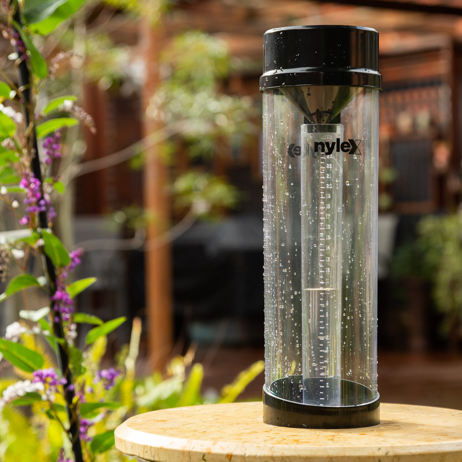
Rain Gauge
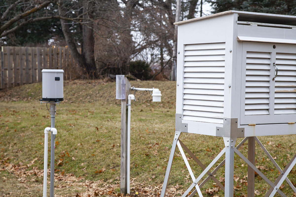
A rain gauge is perhaps the most widely recognized and oldest instrument for measuring precipitation. It is a simple cylindrical-shaped device that collects and measures the amount of rainfall that occurs in a specific area. Rain gauges can be found in various sizes and designs, from small handheld devices to large automated stations.
The basic principle behind a rain gauge is straightforward. It consists of a collection container, usually made of plastic or metal, with markings to indicate the volume of water collected. The container is placed on the ground or mounted on a pole in an open area, away from obstructions such as trees or buildings, to ensure accurate measurements.
When rainfall occurs, the water fills the container, and the height of the water level corresponds to the amount of precipitation that has fallen. The collected water can be emptied and measured using the markings on the rain gauge.
While rain gauges are relatively simple instruments, they do have some limitations. First, they can only measure liquid precipitation, such as rain or drizzle, and are unable to account for other forms of precipitation, such as snow or hail. Additionally, localized factors like wind and evaporation can affect the accuracy of measurements.
Advancements in technology have led to the development of electronic rain gauges that provide more precise measurements and can transmit data wirelessly. These devices utilize sensors to detect the presence and intensity of rainfall and provide real-time data to weather monitoring stations and meteorological networks.
Rain gauges are widely used in meteorology, hydrology, and climate studies. They are essential for monitoring precipitation patterns over time, studying drought conditions, assessing water resources, and calibrating and validating weather radar and satellite measurements. They also play a vital role in everyday applications, such as gardening, water management, and residential weather monitoring.
In summary, rain gauges are simple yet indispensable tools for measuring rainfall. Their ease of use and reliability make them a valuable asset in studying and understanding precipitation patterns, ensuring accurate forecasts, and managing water resources effectively.
Snow Gauge
Unlike rain, which is a liquid form of precipitation, snowfall presents a unique set of challenges when it comes to measurement. Snow gauges, also known as snowfall rulers or snow depth gauges, are specifically designed instruments used to measure the depth of snow accumulation. They are essential tools in regions with cold climates or mountainous areas where snowfall is common.
Snow gauges come in various forms, but the most common design consists of a long and narrow tube or cylinder with markings to indicate the snow depth. The gauge is typically installed in an open area, away from buildings or trees, to ensure accurate measurements and prevent interference from drifting snow or wind.
To measure the snow depth, the gauge is inserted vertically into the snowpack until it reaches the ground level. The height of the snow accumulation is then read directly from the gauge. In some cases, the snow gauge may be equipped with a funnel-like top to account for snow compaction, ensuring more accurate measurements.
One of the challenges faced in measuring snowfall is dealing with factors such as drifting, settling, and melting of snow. These factors can significantly affect the accuracy of measurements. To mitigate this, multiple snow gauges may be installed in different locations to account for variability in snow accumulation.
Advancements in technology have led to the development of automated snow depth sensors that utilize ultrasonic or laser technology to measure the distance between the sensor and the snow surface. These sensors provide real-time data and eliminate the need for manual measurements, especially in remote or inaccessible locations.
Snow gauges and snow depth measurements are crucial for various applications. They are used in weather forecasting to estimate snowfall amounts, particularly in winter storms and snow events. Snow depth data also plays a vital role in hydrological modeling, avalanche forecasting, and assessing the water content stored in the snowpack.
Furthermore, snow gauges help researchers study long-term climate trends, snowmelt patterns, and the impact of changing weather conditions on snow accumulation. They are also valuable for winter sports enthusiasts, ski resorts, and transportation departments in determining snow conditions and planning activities.
In summary, snow gauges are specialized instruments that play a crucial role in measuring snow depth and understanding the characteristics of snowfall. These instruments, along with advancements in technology, provide valuable data for weather forecasting, climate research, and various snow-related applications.
Disdrometer
A disdrometer is an advanced instrument used to measure the size and velocity of falling precipitation particles, such as raindrops or snowflakes. Unlike traditional rain gauges or snow gauges, disdrometers provide detailed information about precipitation characteristics, enabling a deeper understanding of precipitation types and intensity.
Disdrometers work by utilizing various techniques to measure the size and velocity of individual precipitation particles. One common method is the optical disdrometer, which uses laser or optical sensors to detect and analyze the scattering patterns generated by falling raindrops or snowflakes.
As precipitation particles fall through the sensing area of the disdrometer, the sensors capture the scattering properties of the particles, allowing for the calculation of their size and velocity. This information is crucial for determining precipitation type, such as heavy rain, drizzle, or snow, as well as providing insights into the intensity and structure of the precipitation event.
Advanced disdrometers may also measure additional parameters like the shape of precipitation particles, the rainfall rate, and the drop size distribution. This level of detail is especially valuable in studying the microphysics of precipitation and its impact on various environmental processes.
Disdrometers find applications in meteorology, hydrology, and climatology. Meteorologists use disdrometer data to enhance weather models, improve precipitation forecasts, and better understand severe weather phenomena like thunderstorms. Hydrologists rely on disdrometers to monitor the rainfall intensity and assess its impact on runoff and flooding.
In the field of climatology, disdrometers aid in studying long-term precipitation trends, climate change impacts, and regional variations in precipitation characteristics. They also contribute to research on cloud physics, aerosol-cloud interactions, and the formation of hail or ice pellets.
While disdrometers provide valuable insights into precipitation characteristics, they do have limitations. They are sensitive instruments and require careful calibration and maintenance. Additionally, their high cost and specialized expertise required for data interpretation can limit their widespread deployment.
Nevertheless, disdrometers continue to be an essential tool for researchers and meteorological organizations seeking to unravel the intricacies of precipitation. Their ability to measure particle size and velocity offers valuable information for improving precipitation forecasts, water resource management, and understanding the processes that drive our planet’s weather.
A tip for measuring precipitation is to use a rain gauge, which collects and measures the amount of liquid precipitation that falls over a specific period of time.
Ceilometer
A ceilometer is a weather instrument used to measure the height of cloud bases and the vertical visibility in the atmosphere. It provides valuable data for meteorologists, aviation industries, and environmental monitoring agencies to assess cloud cover, fog, and aerosol layers.
Ceilometers work by emitting a laser or infrared beam vertically into the sky and measuring the time it takes for the beam to be reflected back to the instrument. The instrument uses this information to calculate the distance between the instrument and the cloud base or any obstruction in the atmosphere.
The measurements provided by the ceilometer can be used to determine cloud height, cloud cover, cloud type, and vertical visibility. Cloud base height is particularly crucial for aviation safety, enabling pilots to know the clearance they have above the ground or other obstacles.
Modern ceilometers often feature multiple laser beams that allow for vertical profiling of clouds, providing information about cloud layering and thickness. Additionally, some ceilometers can differentiate between aerosol layers and clouds, aiding in air quality studies and atmospheric research.
Ceilometers are widely used in meteorology, particularly in weather forecasting and aviation. Meteorologists use ceilometer data to analyze cloud patterns, track the movement and development of weather systems, and improve the accuracy of cloud cover predictions.
In aviation, ceilometers provide critical information for pilots during takeoff, landing, and in-flight operations. By knowing the cloud base height and vertical visibility, pilots can make informed decisions regarding aircraft altitude, route planning, and potential weather hazards.
Environmental monitoring agencies also use ceilometers to track atmospheric visibility and determine the presence of fog or haze. This information is vital for air quality assessments, pollution monitoring, and identifying potential health risks associated with poor visibility conditions.
Additionally, ceilometers contribute to climate research by providing data on cloud cover and vertical profiling. This information helps scientists study cloud-climate interactions, understand cloud feedback mechanisms, and improve climate models.
While ceilometers offer valuable insights into atmospheric conditions, they do have limitations. Factors like precipitation, dense fog, or low cloud bases can affect the accuracy of measurements. Additionally, ceilometers are sensitive to ambient lighting conditions and may require data filtering and post-processing to ensure accurate results.
Nevertheless, ceilometers continue to be valuable instruments in weather observation and analysis. Their ability to measure cloud base heights, cloud cover, and vertical visibility plays a crucial role in weather forecasting, aviation safety, and environmental monitoring, ultimately contributing to our understanding of the Earth’s atmosphere.
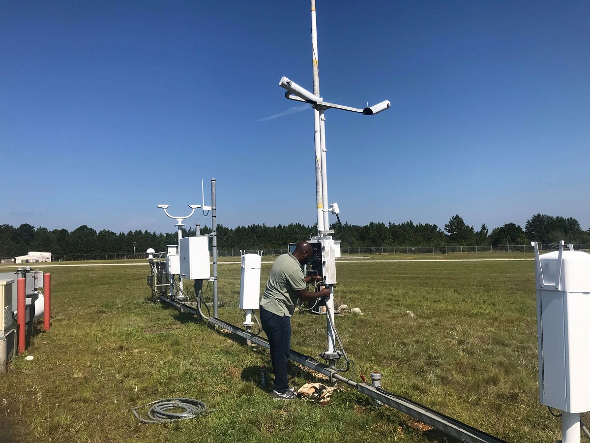
Weather Radar
Weather radar is a powerful tool used to detect and track precipitation, as well as provide valuable information about severe weather phenomena, such as thunderstorms, tornadoes, and hurricanes. It uses electromagnetic waves to measure the location, intensity, and movement of precipitation particles in the atmosphere.
The radar system consists of a transmitter that emits a beam of radio waves and a receiver that detects the reflected waves after they interact with precipitation in the atmosphere. By analyzing the properties of the reflected waves, meteorologists can gather information about the precipitation type, intensity, and structure.
Weather radars operate on the principle of “pulse timing” radar, where short pulses of energy are emitted and the time it takes for the pulses to return provides information about the distance and velocity of the precipitation particles. This allows meteorologists to create real-time images and maps of weather patterns.
One of the significant advantages of weather radar is its ability to detect and track the movement of precipitation over a wide area. This information is crucial for severe weather forecasting, as it enables meteorologists to issue timely warnings and alerts to the public about approaching storms or hazardous weather conditions.
Weather radars can also provide insights into the internal structure of storms, such as the presence of strong updrafts or rotation, which are indicative of severe weather phenomena like tornadoes or supercell thunderstorms. This allows meteorologists to better understand these weather events and improve the accuracy of their forecasts.
Moreover, weather radar data can be used to estimate rainfall accumulation, which is essential for flood forecasting, water resource management, and hydrological modeling. By monitoring the intensity and distribution of rainfall in real-time, meteorologists and scientists can assess the potential impacts on rivers, reservoirs, and communities.
Advanced weather radar systems, such as Doppler radar, also provide information about the velocity of precipitation particles, allowing for the detection of wind patterns within storms. This data is useful for tracking mesocyclones, identifying areas of rotation, and predicting the likelihood of tornado formation.
While weather radar is a highly valuable tool for meteorologists, it does have limitations. It is primarily effective for detecting and tracking precipitation, and its accuracy can be affected by a variety of factors, such as attenuation, ground clutter, and radar beam blockage. Additionally, radar coverage may vary depending on geographical location and the density of radar network infrastructure.
Nevertheless, weather radar plays a crucial role in our understanding and prediction of weather and severe weather events. Its ability to provide real-time data on precipitation, storm movement, and cloud structure helps save lives, protects property, and supports various applications in meteorology, hydrology, and emergency management.
Weather Satellites
Weather satellites are advanced space-based instruments that provide a global and comprehensive view of Earth’s weather patterns and atmospheric conditions. These orbiting observatories are equipped with various sensors and instruments to capture images, collect data, and monitor the Earth’s atmosphere, oceans, and land surfaces.
Weather satellites operate by continuously scanning the Earth’s surface and atmosphere from a vantage point high above the planet. They capture imagery in different wavelengths of light, including visible, infrared, and microwave, allowing meteorologists to analyze cloud cover, temperature variations, moisture content, and other atmospheric features.
One of the significant advantages of weather satellites is their ability to provide near-real-time observations of the Earth’s weather patterns on a global scale. By continuously monitoring the planet, meteorologists can track the development and movement of weather systems, such as cyclones, tropical storms, and frontal boundaries.
The imagery and data collected by weather satellites enable meteorologists to analyze and interpret weather patterns, enhancing their ability to make accurate weather forecasts and issue timely warnings. This information is crucial for predicting severe weather events, such as hurricanes, typhoons, and thunderstorms, and helps governments and emergency management agencies prepare and respond effectively.
Weather satellites also provide valuable information about the Earth’s climate system by monitoring long-term climate trends and changes. They measure key climate variables, such as sea surface temperatures, atmospheric carbon dioxide levels, and ice cover, helping scientists study climate change, assess its impacts, and improve climate models.
Furthermore, weather satellites play a crucial role in monitoring natural disasters, such as wildfires, volcanic eruptions, and dust storms. These satellites provide imagery and data that help authorities track the spread of fires, monitor volcanic activity, and assess the movement of air pollutants, aiding in disaster response and mitigation efforts.
Remote areas, including oceans and polar regions, can also benefit from weather satellites. These satellites provide valuable data on weather conditions in these areas, which are not easily accessible by ground-based weather stations. This helps improve weather forecasts for maritime activities, aviation routes, and scientific research expeditions.
While weather satellites offer significant advantages, they do have limitations. Cloud cover can obstruct satellite imagery, limiting their ability to observe surface features or certain atmospheric phenomena. Additionally, satellite data needs to be validated and calibrated with ground-based measurements to ensure accuracy.
Nevertheless, weather satellites have revolutionized our understanding of Earth’s weather and climate systems. Their continuous and global coverage, along with the wealth of data they provide, significantly contributes to weather forecasting, climate research, and disaster management, ultimately helping us to better understand and navigate the complexities of our planet’s weather and climate.
Conclusion
Weather instruments are essential tools in understanding and monitoring precipitation. From the traditional rain gauge to advanced technologies like weather radar and satellites, these instruments provide valuable data that helps us forecast weather, study climate patterns, and make informed decisions about various aspects of our lives.
Rain gauges have been used for centuries to measure rainfall, providing invaluable information for agriculture, water management, and weather forecasting. Snow gauges enable us to measure the depth of snow accumulation, particularly important in regions with cold climates or mountainous areas. Disdrometers offer insights into the size and velocity of precipitation particles, aiding in the study of microphysics and atmospheric processes.
Ceilometers play a crucial role in measuring cloud base height and vertical visibility, assisting meteorologists and aviation industries in weather prediction and flight safety. Weather radar provides real-time data on precipitation intensity, movement, and severe weather phenomena, helping us issue accurate forecasts and warnings, while weather satellites provide a global view of Earth’s weather patterns, climate trends, and environmental monitoring.
In conclusion, weather instruments are vital in our pursuit of understanding and predicting precipitation. They enable us to gather information about rainfall, snowfall, cloud cover, storm systems, and climate variability. By utilizing these instruments, we can improve our ability to forecast weather, manage water resources, assess environmental conditions, and respond to severe weather events.
As technology continues to advance, weather instruments will evolve to provide even more detailed and accurate measurements, enhancing our understanding of the Earth’s complex climate system. With the continued development of these tools, we can further expand our knowledge and make better-informed decisions to mitigate the impacts of precipitation and ensure a safer and more sustainable future.
Frequently Asked Questions about What Weather Instrument Is Used To Measure Precipitation
Was this page helpful?
At Storables.com, we guarantee accurate and reliable information. Our content, validated by Expert Board Contributors, is crafted following stringent Editorial Policies. We're committed to providing you with well-researched, expert-backed insights for all your informational needs.
0 thoughts on “What Weather Instrument Is Used To Measure Precipitation”