Home>Garden Essentials>How Is Green Space Measured
Garden Essentials
How Is Green Space Measured
Modified: March 7, 2024
Learn how green space is accurately measured and evaluated, including the criteria used to assess the size and quality of gardens.
(Many of the links in this article redirect to a specific reviewed product. Your purchase of these products through affiliate links helps to generate commission for Storables.com, at no extra cost. Learn more)
Introduction
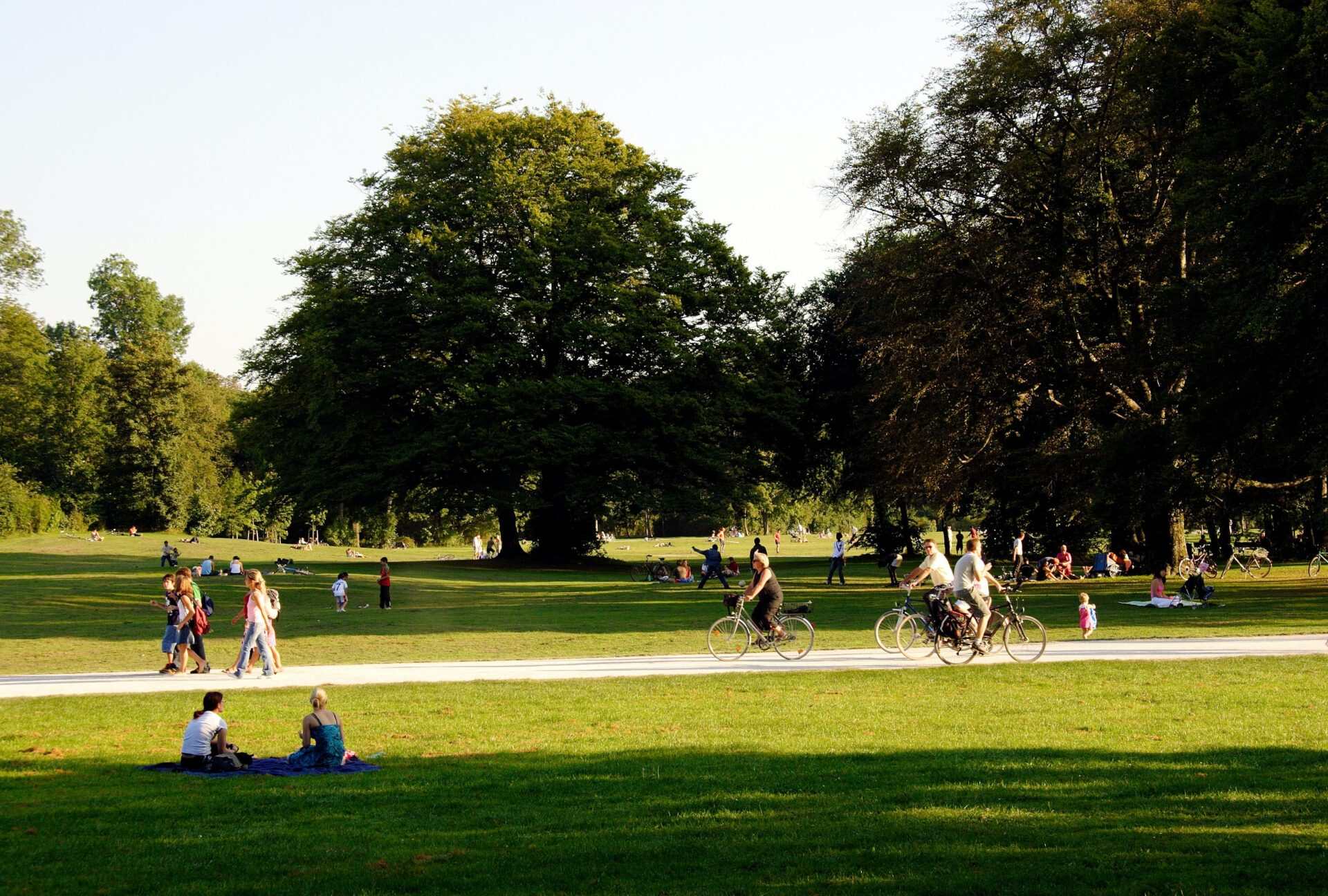
Green space, often referred to as open space or urban greenery, is an essential component of our urban environment. It encompasses parks, gardens, forests, and other areas with vegetation, offering numerous benefits to both humans and the environment. As our cities continue to grow and urbanization expands, the need for proper measurement and management of green spaces becomes increasingly important.
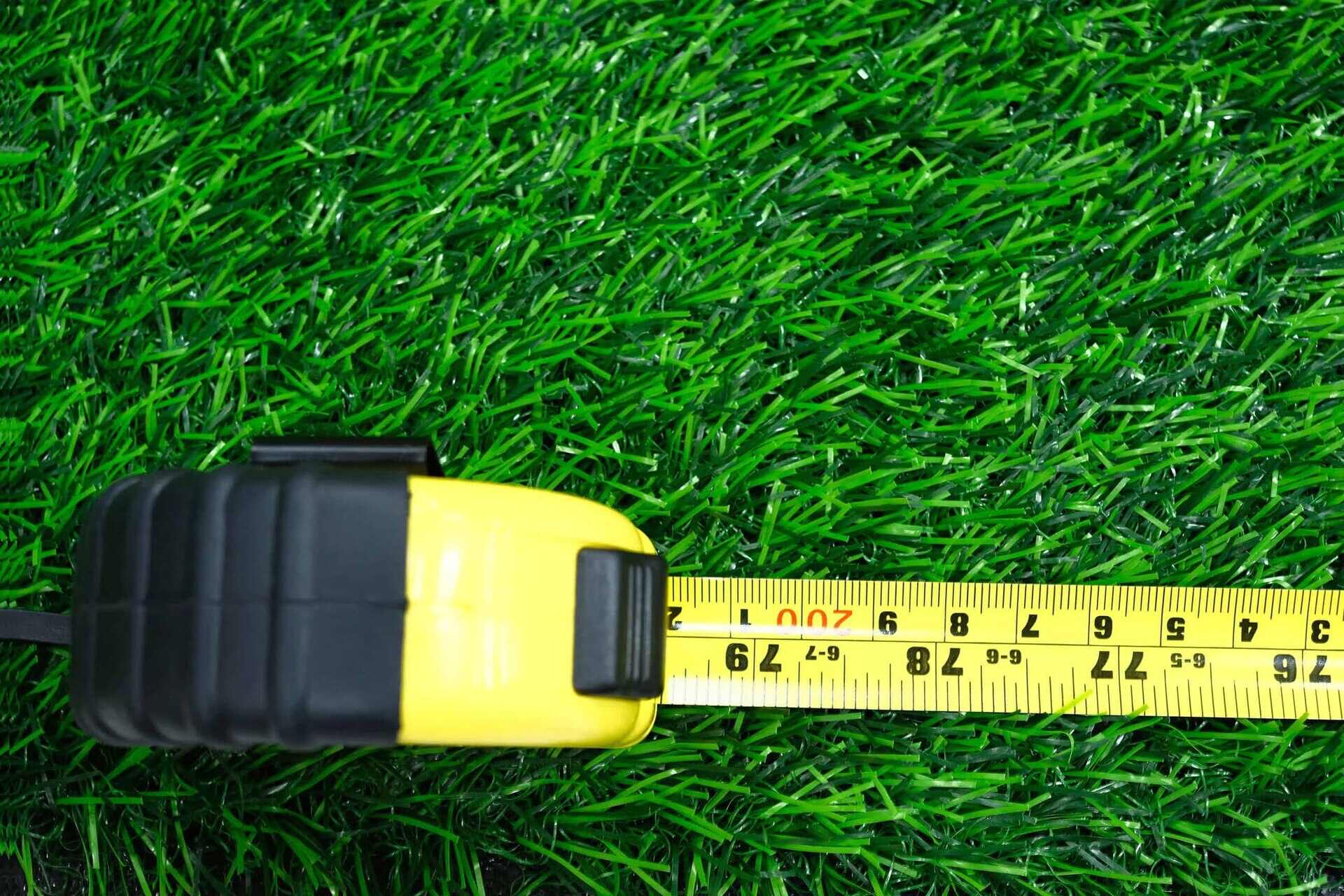
Measuring green space involves quantifying its extent, quality, and accessibility in order to understand its impact and make informed decisions about its preservation and enhancement. This process helps urban planners, landscape architects, and policymakers develop strategies for maintaining and expanding these vital areas.
From the local community park to vast urban forests, green space provides a wide range of benefits. It enhances the aesthetic quality of our neighborhoods, offering a sense of tranquility and beauty amidst the bustling urban environment. Green spaces also serve as gathering places, providing opportunities for recreation, exercise, and social interactions.
Furthermore, green spaces play a crucial role in improving air quality, mitigating climate change, and supporting biodiversity. Trees and plants help to filter pollutants from the air, reducing the impact of air pollution on human health. They also absorb carbon dioxide and release oxygen, contributing to the reduction of greenhouse gas emissions. Additionally, green spaces provide habitats for various flora and fauna, supporting local ecosystems and promoting biodiversity.
However, to effectively manage and protect green spaces, accurate measurement is necessary. This involves determining the size, location, and characteristics of these areas. Green space measurement provides valuable data that can inform decision-making and guide initiatives aimed at preserving, expanding, and improving these spaces.
Various methods and tools are available for measuring green space, ranging from advanced technologies to on-the-ground field surveys. These tools enable professionals to collect and analyze data, producing detailed and accurate information about green space distribution, accessibility, and quality.
In the following sections, we will explore the different methods used to measure green space. These include remote sensing, GIS mapping, field surveys, and the use of geospatial technologies. By understanding these methods and their benefits and limitations, we can gain a comprehensive understanding of how green space measurement contributes to the sustainable development of our urban environments.
Key Takeaways:
- Green spaces, like parks and forests, are crucial for our cities. Measuring them using tools like satellite imagery and field surveys helps us understand their importance and make smart decisions for their preservation and improvement.
- It’s important to measure green spaces accurately, but it can be challenging. We need to work together, use technology, and overcome obstacles to ensure our cities have vibrant and healthy green areas.
Read more: How To Freeze Green Beans From The Garden
Definition of Green Space
Green space, also known as open space or urban greenery, refers to areas within urban environments that are covered by vegetation, such as parks, gardens, forests, and natural landscapes. It is the presence of plants, trees, and other forms of greenery that defines these spaces and distinguishes them from built-up areas.
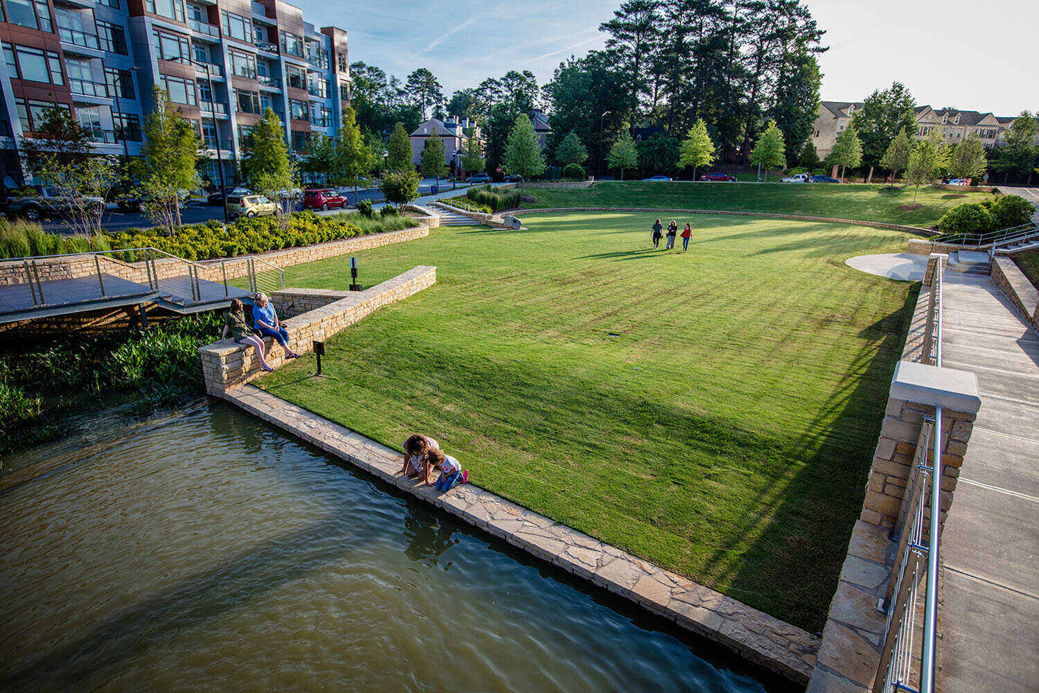
Green spaces come in various sizes and forms, ranging from small community parks and rooftop gardens to large urban forests and protected nature reserves. They serve as important recreational spaces, providing opportunities for physical activity, relaxation, and social interactions. Additionally, green spaces play a crucial role in enhancing the overall quality of life in urban areas.
The concept of green space extends beyond its physical attributes. It also takes into account the accessibility, biodiversity, and ecosystem services provided by these areas. Accessible green spaces are those that are conveniently located and easily reachable by the public, ensuring that people of all ages and abilities can benefit from them.
Biodiversity is another key aspect of green space definition. These areas act as habitats for plants, animals, and insects, fostering ecological diversity and supporting local ecosystems. By providing shelter, food sources, and breeding grounds, green spaces contribute to the preservation of wildlife and promote a balanced natural environment.
Green spaces also offer a range of ecosystem services. Trees and plants help to improve air quality by absorbing pollutants and producing oxygen. They play a role in reducing the urban heat island effect by providing shade and cooling effects. Moreover, green spaces contribute to stormwater management by absorbing and filtering rainwater, reducing the risk of flooding and improving water quality.
In summary, green space can be defined as any area within urban environments that is covered by vegetation, including parks, gardens, forests, and natural landscapes. It includes not only the physical presence of greenery but also factors such as accessibility, biodiversity, and ecosystem services. By understanding the definition of green space, we can appreciate its importance and the need to measure and preserve these areas in our cities.
Importance of Green Space Measurement
Green space measurement is essential for several reasons. It provides valuable information that can guide the planning, development, and management of our urban environments. Here are some key reasons why the measurement of green space is important:
1. Planning and Development: Accurate measurement of green spaces helps urban planners and developers make informed decisions about where and how to create new green areas. It allows them to assess the current distribution of green spaces and identify areas that lack sufficient greenery. By understanding the extent and quality of existing green spaces, planners can strategically allocate resources to ensure equitable access and prioritize areas in need of improvement.
2. Environmental Impact: Green spaces play a vital role in mitigating the environmental impact of urbanization. They help to reduce air pollution by absorbing pollutants and releasing oxygen. Green spaces also assist in managing stormwater by absorbing rainfall and reducing the risk of flooding. Proper measurement of green space allows for a better understanding of how these areas contribute to improving air and water quality, as well as reducing the urban heat island effect.
3. Human Health and Well-being: Numerous studies have shown that access to green spaces has a positive impact on human health and well-being. They provide opportunities for physical activity, stress relief, and social connection. By measuring green spaces, we can assess their accessibility, connectivity, and amenities, ensuring that they cater to the diverse needs of the community. This information can guide efforts to create inclusive and well-designed green spaces that promote public health and well-being.
4. Biodiversity Conservation: Green spaces serve as valuable habitats for a wide range of plant and animal species, contributing to biodiversity conservation. Measuring green spaces helps identify the types of habitats present and assess their ecological value. This information allows for effective conservation planning and the protection of critical habitats for rare or endangered species. Additionally, green space measurement can help monitor the effectiveness of conservation efforts over time.
5. Social and Economic Benefits: Green spaces have been shown to have positive social and economic impacts on communities. They enhance the aesthetic quality of neighborhoods, attracting residents and businesses and increasing property values. By measuring green spaces, we can quantify these benefits and provide evidence-based arguments for investment in the creation and maintenance of green areas. This supports the development of greener and more sustainable cities.
Overall, the measurement of green spaces is crucial for informed decision-making, environmental sustainability, and the well-being of communities. It allows us to understand the current state of green spaces, identify areas of improvement, and monitor the effectiveness of conservation and development efforts. By valuing and measuring green spaces, we can work towards creating healthier, more vibrant, and sustainable urban environments.
Common Green Space Measurement Methods
Measuring green spaces involves collecting data about their extent, quality, and accessibility. Various methods and techniques are used to gather this information, ranging from remote sensing technologies to on-the-ground field surveys. Here are some of the most common green space measurement methods:
1. Remote Sensing: Remote sensing involves using aerial or satellite imagery to capture data about the Earth’s surface. This method provides a bird’s-eye view of green spaces, allowing for the identification and measurement of vegetation cover. From satellite images, experts can analyze the spectral characteristics of the landscape and determine the extent and distribution of green spaces within an area. Remote sensing also enables the monitoring of changes in green space over time, providing valuable insights for urban planning and environmental management.
2. GIS Mapping: Geographic Information Systems (GIS) mapping involves the use of specialized software to analyze and visualize spatial data. GIS allows for the integration of various data layers, including vegetation cover, land use, and population density, to create detailed maps of green spaces. GIS mapping enables accurate measurement and identification of green areas, as well as the assessment of their accessibility and connectivity. It also enables the analysis of potential environmental impacts and the identification of priority areas for green space preservation and development.
3. Field Surveys: Field surveys involve physically visiting and assessing green spaces on the ground. This method collects detailed data about the quality, condition, and biodiversity of green areas. Field surveys may include vegetation sampling, measuring tree canopy cover, and documenting the presence of specific plant and animal species. Field data collection provides valuable information that cannot be captured through remote sensing alone, such as the health and overall condition of green spaces. It also allows for community engagement and the involvement of local stakeholders in the measurement process.
4. Use of Geospatial Technologies: Geospatial technologies, such as Global Positioning System (GPS) and mobile applications, are increasingly utilized in green space measurement. GPS devices accurately determine the geographic location of specific points of interest within green spaces, enabling precise mapping and measurement. Mobile applications can be used to collect data in the field, streamlining the measurement process and facilitating data management. These technologies enhance the efficiency and accuracy of data collection and allow for real-time data analysis and decision-making.
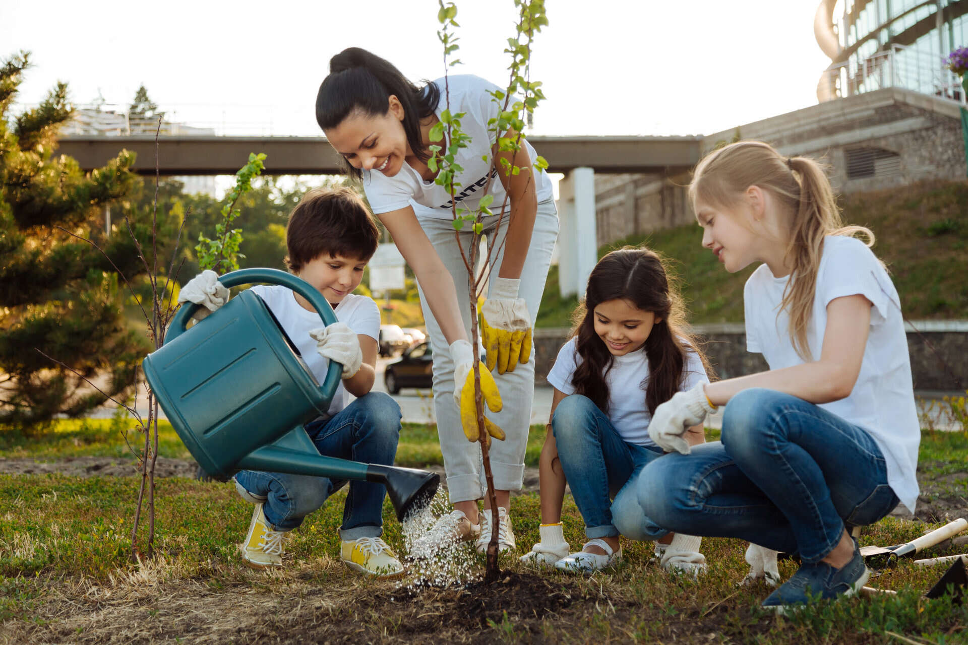
5. Citizen Science: Citizen science initiatives involve engaging the public in the measurement and monitoring of green spaces. This approach empowers individuals and communities to contribute to data collection efforts, fostering a sense of ownership and connection to the green spaces in their surroundings. Citizen science projects can involve tasks such as recording observations of plant and animal species, documenting changes in land use, and assessing the quality of green spaces. By involving citizens in measurement efforts, a larger amount of data can be collected, leading to a more comprehensive understanding of green space distribution and conditions.
By utilizing a combination of these measurement methods, professionals can obtain a comprehensive understanding of green spaces. The integration of remote sensing, GIS mapping, field surveys, and geospatial technologies allows for accurate measurement, monitoring, and assessment of these vital areas. These methods provide essential data to inform decision-making, guide urban planning, and promote the sustainable management and preservation of green spaces.
Remote Sensing
Remote sensing is a powerful method for measuring and monitoring green spaces. It involves the use of aerial or satellite imagery to collect data about Earth’s surface, including vegetation cover, land use, and spatial patterns. Remote sensing enables a comprehensive understanding of green space distribution, size, and condition, providing valuable information for urban planning, environmental management, and conservation efforts.
The process of remote sensing begins with the collection of high-resolution imagery obtained from satellites or aerial platforms. These images capture different wavelengths of light, ranging from visible to infrared. The spectral characteristics of vegetation, such as its reflectance and absorption properties, can be derived from these images to determine the health and density of green spaces.
One of the key benefits of remote sensing is its ability to cover large areas and capture data on a regular basis. With satellite imagery, extensive regions can be surveyed, providing a broad view of green space distribution within cities or across landscapes. This information is crucial for understanding how green spaces are connected and how they interact with surrounding built-up areas.
Remote sensing also allows for monitoring changes in green spaces over time. By comparing images taken at different intervals, urban planners and environmentalists can identify trends, detect vegetation loss or gain, and assess the impact of land use changes on green spaces. This information can inform policy decisions, prioritize conservation efforts, and evaluate the effectiveness of restoration projects.
One popular remote sensing technique used in green space measurement is Normalized Difference Vegetation Index (NDVI). NDVI measures the density and health of vegetation by comparing the reflectance of red and infrared light. Healthy vegetation absorbs more red light and reflects more infrared light, resulting in a higher NDVI value. By using this index, remote sensing experts can accurately identify areas of high vegetation cover and analyze the overall health of green spaces.
Another advantage of remote sensing is its ability to provide data at different spatial resolutions. High-resolution imagery enables the identification of individual trees, vegetation patches, and detailed features within green spaces. This level of detail is valuable for assessing the quality, diversity, and structure of green spaces, as well as detecting changes in land cover over time.
However, remote sensing does have some limitations. Cloud cover can obstruct satellite images, limiting data availability for certain areas and time periods. Additionally, the interpretation of remote sensing data requires expertise and knowledge of vegetation indices and image processing techniques. Therefore, remote sensing should be complemented with on-the-ground field surveys and other green space measurement methods to ensure the accuracy and reliability of the data.
Overall, remote sensing is a valuable tool for measuring and monitoring green spaces. It provides a comprehensive and up-to-date view of green space distribution, health, and changes over time. By harnessing the power of satellite and aerial imagery, remote sensing helps guide urban planning, conservation efforts, and the sustainable management of green spaces.
When measuring green space, consider using Geographic Information Systems (GIS) to analyze satellite imagery and map out the amount and distribution of green areas in a given area. This can help provide a comprehensive understanding of the green space available.
Read more: How To Cook Green Beans From Garden
GIS Mapping
GIS mapping, or Geographic Information Systems mapping, is a method used to analyze and visualize spatial data related to green spaces. It involves the use of specialized software and geographic datasets to create detailed maps that depict the distribution, extent, and characteristics of green spaces within urban environments. GIS mapping plays a crucial role in the measurement and management of green spaces, providing valuable insights for decision-making and planning.
One of the primary advantages of GIS mapping is its ability to integrate various data layers. Green space data, including vegetation cover, land use classification, and accessibility, can be combined with demographic information such as population density, socioeconomic factors, and transportation networks. By overlaying these datasets, urban planners and environmentalists gain a comprehensive understanding of the spatial relationships and interactions between green spaces and other urban features.
Using GIS mapping, professionals can accurately measure the size and boundaries of green spaces. They can delineate and classify different types of green areas, including parks, gardens, and forests. These maps help identify gaps in green space coverage and ensure equitable distribution throughout urban areas.
GIS mapping also allows for the assessment of green space connectivity and accessibility. By measuring distances between green spaces and residential areas, schools, and other public facilities, planners can identify areas that lack easy access to green spaces. This information helps guide efforts to improve connectivity and ensure that green spaces are conveniently located for all residents, promoting health and well-being.
Another benefit of GIS mapping is its ability to analyze and visualize environmental parameters of green spaces. By collecting and integrating data on vegetation health, air quality, soil conditions, and water resources, professionals can assess the overall quality and functionality of green spaces. This information enables targeted interventions to improve the ecological value and ecosystem services provided by green spaces.
One of the powerful features of GIS mapping is its ability to model and simulate the impact of different factors on green spaces. Planners can overlay future urban development scenarios, account for population growth, and calculate the potential effects on green space availability. This forecasting capability helps guide decision-making and ensure that green spaces are adequately protected and preserved in the face of urban expansion.
GIS mapping is not limited to professionals only. Web-based mapping platforms and mobile applications allow the public to access and interact with green space data. These user-friendly interfaces enable residents to explore and contribute to the measurement of green spaces, promoting community engagement and empowering individuals to participate in urban planning and environmental management processes.
In summary, GIS mapping is a powerful method for measuring and analyzing green spaces. Its ability to integrate diverse data layers, assess connectivity and accessibility, and model future scenarios makes it an invaluable tool for urban planning. By utilizing GIS mapping, professionals can make informed decisions, promote sustainable development, and ensure the effective management and preservation of green spaces in our urban environments.
Field Surveys
Field surveys are an essential method for measuring and assessing green spaces by conducting on-site data collection and observations. This hands-on approach allows for detailed information to be gathered about the quality, condition, and biodiversity of green areas. Field surveys provide valuable data that complements other measurement methods and contributes to a comprehensive understanding of green spaces.
One of the primary purposes of field surveys is to assess the health and condition of vegetation within green spaces. This involves conducting vegetation sampling, measuring tree canopy cover, and assessing the presence of invasive species or diseases. By collecting this data, experts can evaluate the overall vitality and ecological integrity of green areas.
Field surveys also allow for the collection of information about user preferences and behaviors within green spaces. Observations of visitor activities, such as walking, picnicking, or playing sports, can help in understanding how people interact with these areas and what amenities are valued. This information is crucial for improving the design and management of green spaces to meet the diverse needs of the community.
Additionally, field surveys enable the identification of specific plant and animal species present in green spaces. This information contributes to the assessment of biodiversity and ecological value. Field experts can document the presence of rare, threatened, or invasive species, helping to guide conservation efforts and improve habitat management strategies.
Field surveys also provide an opportunity for community engagement and involvement in the measurement process. Citizen science initiatives encourage the public to participate in collecting data about green spaces. Individuals can contribute by recording observations of plant and animal species, documenting changes in land use, or assessing the perceived quality of green areas through surveys. This collaborative approach fosters a sense of ownership and stewardship among community members and enhances the accuracy and breadth of the data collected.
Field surveys offer several advantages compared to remote sensing or GIS mapping. They provide a more detailed and fine-grained analysis of green spaces, capturing on-the-ground realities that are not always captured through satellite imagery. Field surveys also offer an opportunity for direct interaction with the local environment, allowing researchers and experts to gain a deeper understanding of the challenges and opportunities within green spaces.
However, field surveys do have limitations, particularly in terms of scale and time-consuming nature. They may be limited to specific locations or smaller areas, making it challenging to gather comprehensive data for larger regions. Additionally, field surveys require trained professionals or community volunteers to conduct the observations, which can be resource-intensive.
In summary, field surveys play a crucial role in measuring and assessing green spaces. They provide valuable data on vegetation health, user preferences, biodiversity, and community engagement. By complementing other measurement methods, such as remote sensing and GIS mapping, field surveys offer valuable insights into the condition and functionality of green spaces and contribute to their sustainable management and conservation.
Use of Geospatial Technologies
The use of geospatial technologies has revolutionized the measurement and analysis of green spaces. These advanced tools and techniques harness the power of technology to collect, manage, and analyze spatial data related to green areas. Geospatial technologies such as Global Positioning System (GPS) devices, mobile applications, and Geographic Information Systems (GIS) enable accurate and efficient data collection, real-time analysis, and informed decision-making regarding green space management and preservation.
One of the key applications of geospatial technologies in measuring green spaces is the use of GPS devices. GPS allows for precise location tracking, enabling professionals to accurately map the boundaries, features, and amenities of green areas. GPS devices facilitate the collection of spatial data on vegetation cover, trail networks, infrastructure, and access points. This information is crucial for creating detailed inventories and understanding the spatial characteristics and connectivity of green spaces.
Mobile applications have also emerged as powerful tools for collecting and managing green space data. These applications allow for the integration of GPS functionality, camera capabilities, and data entry forms, streamlining the data collection process. Users can capture photographs, record observations, and document the quality and condition of green spaces on-site. These real-time data entry methods improve the accuracy and efficiency of data collection and provide up-to-date information for analysis and decision-making.
Geographic Information Systems (GIS) play a central role in the integration, analysis, and visualization of green space data. GIS software allows for the overlaying of various spatial layers, including vegetation cover, land use, and demographic data. Through GIS, professionals can create complex maps and models that provide insights into the relationships between green spaces and other urban features. GIS also enables spatial analysis, such as identifying areas with inadequate green space coverage or determining the impact of land use changes on the ecological functionality of green areas.
Remote sensing data, such as aerial imagery or satellite images, can be integrated into GIS platforms to provide a comprehensive view of green space distribution and characteristics. GIS tools can process and analyze remote sensing data to derive vegetation indices, monitor changes over time, and assess the health and vitality of green spaces. This integration of remote sensing and GIS allows for a holistic understanding of green spaces and supports evidence-based decision-making.
Another important application of geospatial technologies is the creation of web-based mapping platforms. These platforms allow for the dissemination of green space data to the public and stakeholders. Interactive maps can display information about park amenities, trail networks, and ecological features. This accessibility improves transparency, facilitates community engagement, and empowers individuals to contribute to green space measurement and management efforts.
Despite the many benefits of geospatial technologies, challenges still exist. The successful implementation of these technologies requires technical expertise, access to reliable data sources, and adequate resources. Training and capacity building are essential to ensure that professionals and community members can effectively utilize geospatial technologies for green space measurement and management.
In summary, the use of geospatial technologies such as GPS devices, mobile applications, and GIS has significantly enhanced the measurement and analysis of green spaces. These technologies enable accurate data collection, efficient data management, and advanced spatial analysis. By harnessing the power of geospatial technologies, professionals and communities can make informed decisions and effectively manage and preserve green spaces for the benefit of both people and the environment.
Challenges in Green Space Measurement
While green space measurement is essential for effective urban planning and environmental management, it is not without its challenges. Several factors can hinder the accurate and comprehensive measurement of green spaces. Understanding and addressing these challenges is crucial to ensure the reliability and usefulness of the data collected. Here are some common challenges in green space measurement:
1. Define Boundary: Defining the boundary of a green space can be challenging, especially for large or fragmented areas. Green spaces often have varying boundaries or may blend with other land uses, making it difficult to determine their precise extent. Additionally, some green spaces may be privately owned or have access restrictions, further complicating the measurement process.
2. Data Availability and Quality: Availability and quality of data can be a significant challenge in green space measurement. Data may be outdated, inconsistent, or incomplete, leading to inaccuracies in the measurement and analysis process. Obtaining reliable data on variables such as vegetation cover, biodiversity, and visitor activities may require extensive field surveys, which can be resource-intensive and time-consuming.
3. Scale and Resolution: Green space measurement needs to account for different scales and resolutions. Satellite imagery may provide a broad view of large green areas but lacks the detail needed to assess smaller features within these spaces. Balancing the need for rich detail without sacrificing the broader context of green spaces can be a challenge, especially when using remote sensing and GIS mapping techniques.
4. Data Integration: Integrating diverse datasets from various sources can be challenging due to differences in formats, scales, and quality. Combining data layers related to vegetation cover, land use, accessibility, and community preferences requires a robust and well-designed data integration strategy. It is important to ensure data compatibility and establish suitable frameworks to handle and analyze different types of data efficiently.
5. Community Engagement and Data Ownership: Engaging the community and stakeholders in green space measurement can be challenging. Building trust, ensuring inclusivity, and addressing concerns regarding data ownership and privacy are critical for successful community engagement. Balancing the need for community involvement while maintaining data integrity and accuracy requires robust communication and participatory approaches.
6. Access and Equity: Access to green spaces is not evenly distributed, with some communities facing limited access and poor connectivity. Measuring green space requires considering these access and equity issues to ensure that the data collected reflects the needs and experiences of all community members, particularly marginalized populations. Incorporating socio-economic and demographic data can provide insights into equity in green space distribution and accessibility.
7. Dynamic Nature of Green Spaces: Green spaces are dynamic and subject to change over time due to natural processes, urban development, and climate factors. Keeping up-to-date information on changes in land use, vegetation cover, and ecological characteristics can be challenging. Regular monitoring and updating of green space data are essential to capture these changes accurately.
8. Resource Constraints: Green space measurement requires financial and human resources, including trained personnel, technology, and data management infrastructure. Limited resources can constrain the extent and quality of data collection, leading to compromised measurements. Allocating sufficient resources to green space measurement is necessary to obtain reliable and comprehensive data.
Efforts to address these challenges require collaboration among various stakeholders, including government agencies, researchers, community organizations, and technology providers. Developing standardized protocols, improving data sharing, and investing in capacity building can help overcome these challenges and foster more accurate and comprehensive measurement of green spaces, ensuring their effective management and preservation for the benefit of present and future generations.
Read more: How To Store Mixed Greens
Conclusion
Green space measurement is a crucial component of urban planning, environmental management, and the preservation of our natural environment. Accurately measuring the extent, quality, and accessibility of green spaces provides important data for understanding their significance and guiding decision-making processes.
Through methods like remote sensing, GIS mapping, field surveys, and the use of geospatial technologies, professionals can gather comprehensive information about green spaces. Remote sensing allows for a bird’s-eye view of green spaces, uncovering patterns and changes over time. GIS mapping integrates various data layers to create detailed and informative maps, aiding in planning and analysis. Field surveys provide on-the-ground insights into the health, condition, and biodiversity of green spaces. The use of geospatial technologies, such as GPS devices and mobile applications, enables real-time data collection and analysis, empowering individuals and communities to contribute to the measurement process.
However, green space measurement is not without its challenges. Establishing clear boundaries, ensuring data availability and quality, addressing issues of scale and resolution, integrating diverse datasets, and engaging communities are among the hurdles that need to be overcome. Additionally, considering issues of access and equity, the dynamic nature of green spaces, and resource constraints are fundamental to achieving accurate and comprehensive measurement.
By addressing these challenges and investing in green space measurement, we can make informed decisions regarding the planning, development, and management of our green spaces. Measurement provides the foundation for equitable access, preservation of biodiversity, enhancement of environmental quality, and promotion of human health and well-being. It enables us to create sustainable, vibrant, and inclusive cities that prioritize the preservation and enhancement of our precious green spaces.
Moving forward, it is essential for stakeholders and professionals to collaborate, share data, and invest in capacity building to ensure accurate and comprehensive green space measurement. By valuing and measuring these areas, we can preserve and enhance the ecological, social, and economic benefits they provide for ourselves and future generations.
Frequently Asked Questions about How Is Green Space Measured
Was this page helpful?
At Storables.com, we guarantee accurate and reliable information. Our content, validated by Expert Board Contributors, is crafted following stringent Editorial Policies. We're committed to providing you with well-researched, expert-backed insights for all your informational needs.


0 thoughts on “How Is Green Space Measured”