Home>diy>Building & Construction>What Is Construction Surveying
Building & Construction
What Is Construction Surveying
Modified: October 21, 2024
Learn all about construction surveying, a crucial aspect of building construction. Discover the importance of accurate measurements and precise positioning in this comprehensive guide.
(Many of the links in this article redirect to a specific reviewed product. Your purchase of these products through affiliate links helps to generate commission for Storables.com, at no extra cost. Learn more)
Introduction
Construction surveying plays a crucial role in the building and construction industry. It involves the precise measurement and mapping of land and structures to ensure accurate placement and alignment of various components in the construction process. Construction surveying is an essential step in the planning, design, and execution of construction projects, ensuring that structures are built to specifications and meet safety standards.
Construction surveying combines the use of technology, such as global positioning systems (GPS), remote sensing, and computer-aided design (CAD), with the expertise of skilled surveyors to provide accurate and reliable data. This information is vital for architects, engineers, and contractors to make informed decisions, minimize errors or discrepancies, and ensure the successful completion of construction projects.
The primary objective of construction surveying is to establish precise locations, outlines, and elevations of various project elements, including buildings, roads, drainage systems, utilities, and other infrastructure. This information serves as a reference for layout, excavation, foundation construction, grading, and the installation of structural components.
Throughout this article, we will delve into the definition, importance, role, process, tools, techniques, applications, challenges, and future trends of construction surveying. By understanding these key aspects, you will gain insight into this critical field and appreciate its significance in the construction industry.
Key Takeaways:
- Construction surveying is vital for accurate construction, ensuring precise measurements, proper alignment, and compliance with safety standards. It plays a pivotal role in site analysis, layout, and quality control, contributing to the success of construction projects.
- The future of construction surveying is marked by technological advancements, sustainability, and enhanced collaboration. Trends such as robotics, BIM integration, remote sensing, and AR/VR will drive more efficient, accurate, and sustainable surveying processes.
Read more: What Is Surveying In Civil Engineering
Definition of Construction Surveying
Construction surveying, also known as construction layout or site surveying, is the process of accurately measuring and mapping the physical features of a construction site. It involves the use of specialized surveying instruments and techniques to determine the precise locations, dimensions, and elevations of various structures and components within the project site.
The primary goal of construction surveying is to translate the design plans and specifications into the physical world. It ensures that the construction meets the required standards and is in accordance with the intended layout. The surveying data is used to guide the construction process, ensuring that the project is built correctly and within the specified tolerances.
Construction surveying is typically conducted in the early stages of a construction project, before any excavation or construction work begins. It starts with a topographic survey, which involves mapping the existing features of the site, such as the terrain, trees, and existing structures. This information is crucial for understanding the site conditions and planning the construction process.
Once the topographic survey is complete, the construction surveyor will then establish control points, which are reference points used as a basis for all subsequent measurements. These control points are typically located outside the construction site and are used to accurately position and align the structures within the project site.
In addition to establishing control points, construction surveyors also play a vital role in ensuring proper alignment and elevation of various elements during the construction process. They provide guidance for setting out the foundation, columns, walls, and other structural elements, ensuring that they are correctly positioned and aligned according to the design plans.
Overall, construction surveying is a critical component of the construction process, as it helps to ensure the accuracy and integrity of the final built structure. It allows for precise measurement and placement of components, minimizing errors, and ensuring that the construction meets safety standards and design specifications.
Importance of Construction Surveying
Construction surveying plays a pivotal role in the success of construction projects. It is a fundamental process that provides accurate and reliable data to architects, engineers, and contractors, aiding in the planning, design, and execution of construction projects. Here are some key reasons why construction surveying is vital:
1. Site Analysis and Planning: Construction surveying begins with a topographic survey, which helps to analyze the existing site conditions. This information is crucial for understanding the terrain, slopes, drainage patterns, and other geographic features. Surveyors provide valuable insights into potential challenges or constraints that may influence the construction process and help planners make informed decisions.
2. Precision and Accuracy: Construction surveyors use advanced equipment and techniques to ensure precise measurements and accurate positioning of structures. This level of accuracy is essential to maintain design integrity, ensure proper alignment, and prevent potential issues such as structural defects or safety hazards.
3. Layout and Marking: Construction surveyors play a critical role in the establishment of control points, reference markers that guide construction activities. These points assist in accurately setting out building foundations, columns, walls, and other elements, ensuring they align precisely with the design plans. Proper layout and marking prevent errors and discrepancies that can arise during the construction process.
4. Compliance and Safety: Construction surveying helps ensure compliance with building codes, regulations, and safety standards. By accurately positioning structures and components, surveyors assist in mitigating potential safety concerns, ensuring that buildings are constructed within legal boundaries and with adherence to local regulations.
5. Cost and Time Efficiency: Effective construction surveying helps in reducing costs and saving time. Accurate measurements and precise positioning help minimize errors, rework, and material wastage. The early identification of design or layout issues allows for timely resolution, preventing costly delays and revisions.
6. Project Coordination: Construction surveyors act as a bridge between various stakeholders, including architects, engineers, and contractors. They ensure effective communication and coordination among different teams, helping to align construction activities according to the project timeline and specifications.
Overall, construction surveying is vital for the successful implementation of construction projects. It provides the necessary data and guidance to ensure accuracy, compliance, and efficient construction processes, resulting in safe and high-quality built structures.
Role of Construction Surveyors
Construction surveyors play a crucial role in the construction industry, providing valuable expertise and guidance throughout the construction process. They are responsible for collecting and analyzing precise measurements and data to ensure accurate placement and alignment of structures. Here are some key roles and responsibilities of construction surveyors:
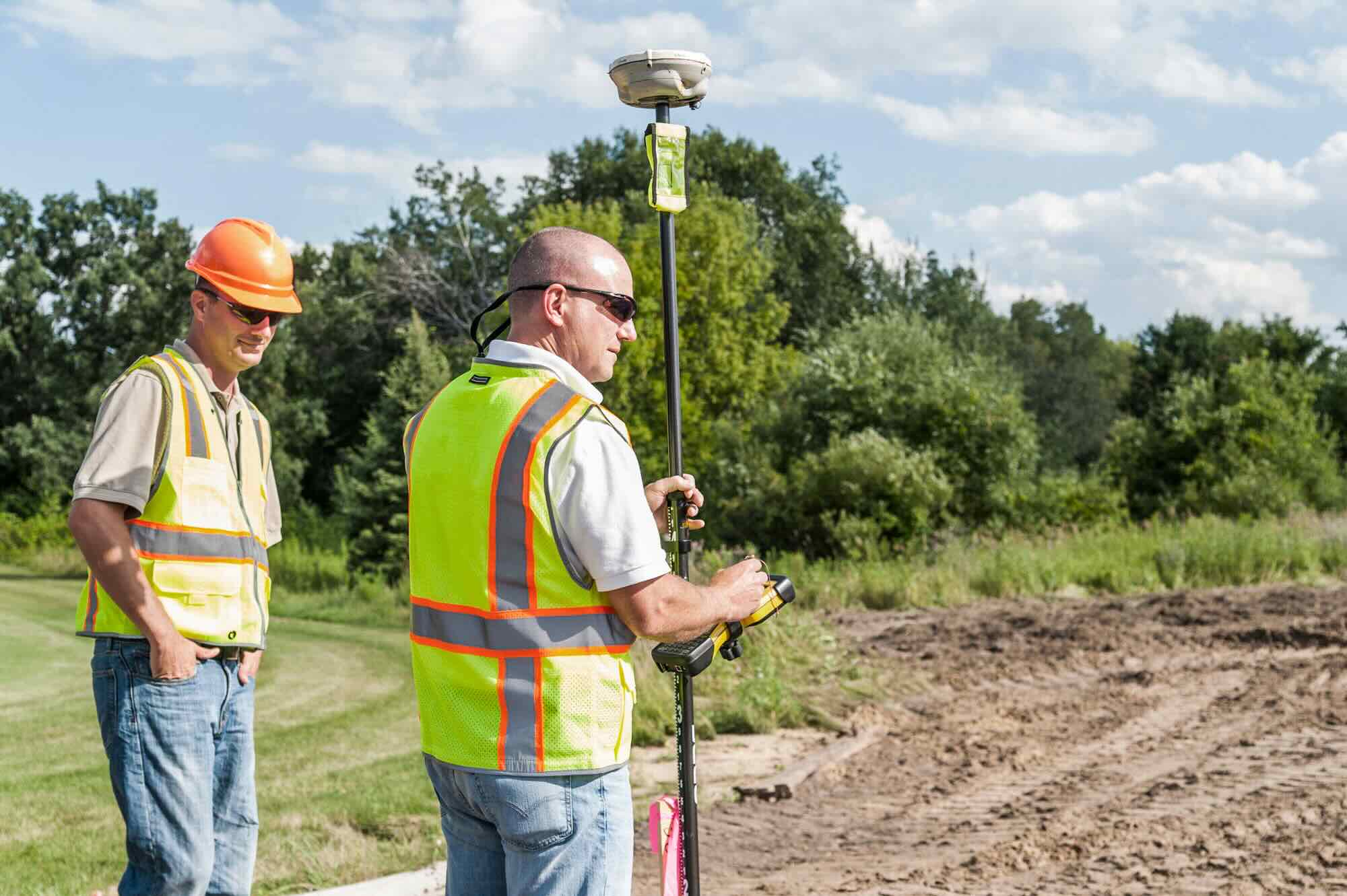
1. Data Collection and Analysis: Construction surveyors conduct topographic surveys to collect data on the existing site conditions, including the terrain, natural features, and existing structures. They use specialized surveying equipment such as GPS receivers, total stations, and laser scanners to collect accurate measurements and create detailed maps and models of the construction site.
2. Control Point Establishment: Construction surveyors establish control points, which serve as reference markers for all subsequent measurements and construction activities. These control points ensure precise positioning and alignment of structures, and they provide a framework for the construction process.
3. Layout and Marking: Construction surveyors are responsible for accurately marking and staking out various elements of the construction project, including building boundaries, foundations, columns, walls, and utilities. They use the control points as a guide to ensure proper alignment and adherence to the design plans.
4. Monitoring and Verification: Construction surveyors continuously monitor the progress of construction to ensure that the structures are being built according to specifications. They verify the accuracy of each phase of the construction process, conducting regular inspections and measurements to identify any deviations or errors that need to be corrected.
5. Quality Control and Assurance: Construction surveyors play a significant role in quality control and assurance. They ensure that the construction work meets the required standards and complies with building codes and regulations. They conduct precision measurements and inspections to identify any issues or discrepancies and work closely with architects, engineers, and contractors to implement necessary corrections.
6. Collaboration and Communication: Construction surveyors work closely with various stakeholders, including architects, engineers, contractors, and other professionals involved in the construction project. They communicate and collaborate effectively to ensure that everyone is aligned with the project objectives and requirements.
7. Problem Solving and Troubleshooting: Construction surveyors are skilled problem solvers, capable of identifying and resolving issues that arise during the construction process. They use their knowledge of surveying principles, combined with practical experience, to overcome challenges and ensure the successful completion of the project.
Overall, construction surveyors play a crucial role in ensuring that construction projects are executed accurately and efficiently. Their expertise and attention to detail contribute to the successful implementation of construction plans, resulting in safe and visually appealing built environments.
Process of Construction Surveying
The process of construction surveying involves several steps that are critical to the success of a construction project. From the initial site analysis to the final verification, construction surveyors carry out a systematic process to ensure precise measurements and accurate placement of structures. Here is an overview of the typical process of construction surveying:
1. Site Analysis: The first step in construction surveying is to conduct a topographic survey of the construction site. This involves mapping the existing features of the site, including the terrain, vegetation, bodies of water, and existing structures. The site analysis provides crucial information about the site conditions, helping to assess potential challenges and impacts on the construction process.
2. Establishing Control Points: Construction surveyors establish control points, which serve as reference points for all subsequent measurements and construction activities. These points are accurately positioned outside the construction site and are typically marked using permanent benchmarks or temporary stakes. The control points provide a stable and reliable framework for the construction process, ensuring accurate placement and alignment of structures.
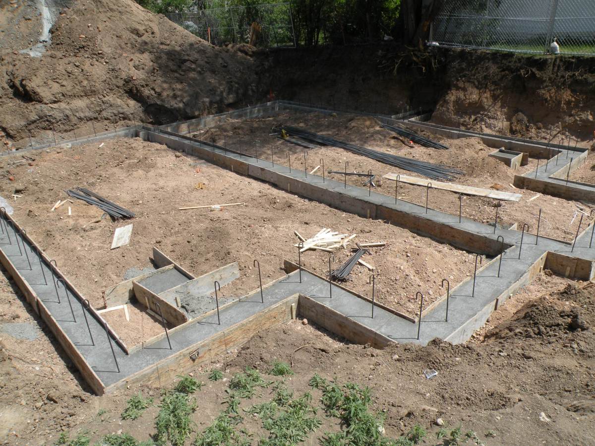
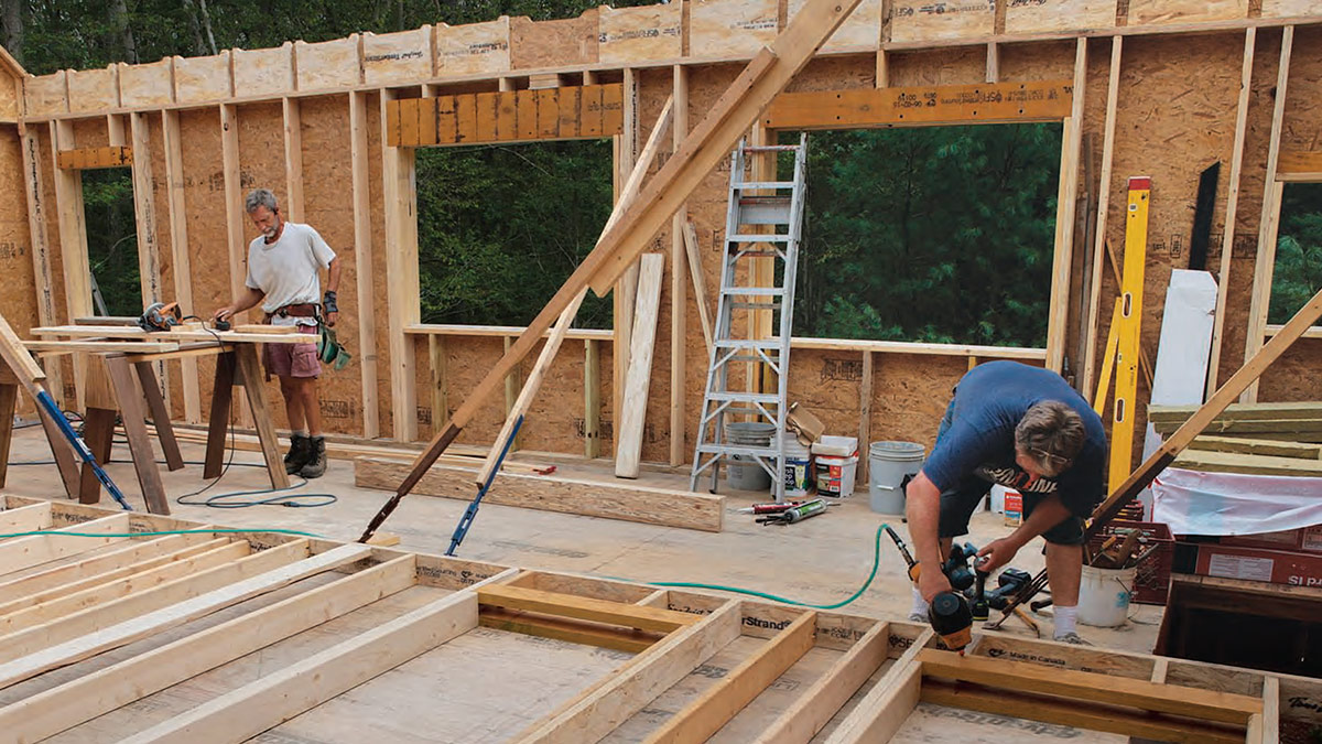
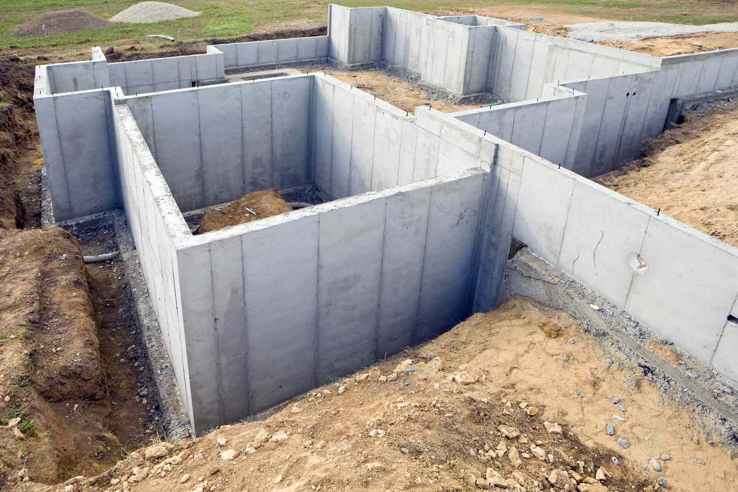
3. Layout and Marking: Once the control points are established, construction surveyors translate the design plans into the physical world by marking out various elements of the construction project. This includes staking out building boundaries, foundations, columns, walls, utilities, and other structures. Precise measurements are taken to ensure that the layout is in accordance with the design plans and specifications.
4. Monitoring Construction Progress: Construction surveyors continuously monitor the construction progress to ensure adherence to the design plans. They conduct regular inspections and measurements to verify that the structures are being built accurately and according to specifications. Any deviations or errors are identified and addressed promptly to prevent further issues.
5. Quality Control and Assurance: Construction surveyors play a crucial role in quality control and assurance. They conduct precision measurements and inspections to ensure that the construction work meets the required standards and complies with building codes and regulations. They work closely with architects, engineers, and contractors to identify and resolve any issues or discrepancies that arise during the construction process.
6. Final Verification: Once the construction is nearing completion, construction surveyors conduct a final verification process. This involves cross-checking the as-built measurements with the design plans to ensure that all structures and components are in the correct position and alignment. Any necessary adjustments or corrections are made before the project is considered complete.
Throughout the process, construction surveyors utilize advanced surveying equipment such as GPS receivers, total stations, laser scanners, and computer-aided design (CAD) software to collect accurate measurements, analyze data, and create detailed maps and models of the construction site. Their expertise in surveying principles and techniques, combined with their understanding of construction processes, ensures accurate and reliable data that is essential for the successful execution of construction projects.
Read more: What Is A Laser Level For Surveying
Tools and Equipment Used in Construction Surveying
Construction surveying requires the use of specialized tools and equipment to collect accurate measurements and perform various surveying tasks. These tools and equipment enable construction surveyors to carry out their responsibilities efficiently and effectively. Here are some common tools and equipment used in construction surveying:
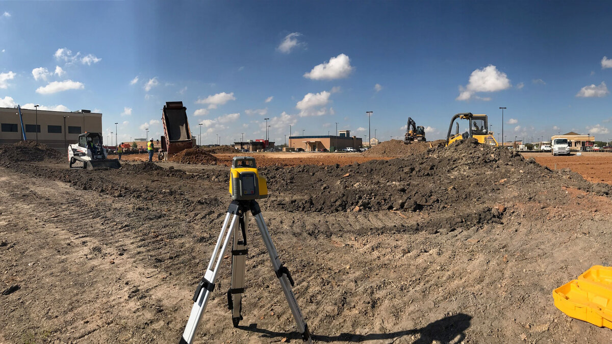
1. Total Station: A total station is a high-precision electronic instrument used for measuring angles and distances. It integrates a theodolite (for measuring angles) and a distance meter (for measuring distances) into a single device. Total stations have advanced features such as electronic data collection, auto-tracking, and reflectorless measurement capabilities, making them essential tools for construction surveyors.
2. Global Positioning System (GPS) Receivers: GPS receivers are used to determine precise positions on the Earth’s surface. Construction surveyors utilize GPS receivers to establish control points and collect accurate measurements of various points on the construction site. GPS technology provides real-time positioning information, making it an efficient tool for large-scale construction projects.
3. Laser Scanner: Laser scanners are used to create highly accurate and detailed 3D models of construction sites. They emit laser beams that measure distances and capture millions of data points, which are used to create point clouds and highly detailed digital models. Laser scanners are particularly useful for large-scale projects and complex structures.
4. Automatic Level: An automatic level is a tool used to measure height differences or elevations between different points. It consists of a telescope mounted on a stable tripod, with an internal compensator that automatically levels the instrument. Automatic levels are commonly used for setting accurate elevation benchmarks and for determining the slopes and grades of the construction site.
5. Digital Levels: Digital levels are electronic leveling instruments that provide accurate and precise measurements of height differences. They have built-in sensors and display units, eliminating the need for manual reading and calculation. Digital levels offer increased speed and accuracy compared to traditional leveling methods.
6. Surveying Prisms and Targets: Prisms and targets are used in conjunction with total stations and GPS receivers. They reflect the surveying instrument’s signals back to provide accurate measurements. Prisms are typically used for long-range measurements, while targets are used for close-range measurements.
7. Measuring Tapes and Ranging Poles: Measuring tapes and ranging poles are essential tools for taking linear measurements on the construction site. Measuring tapes provide accurate distance measurements, while ranging poles are used as reference points for measuring distances and heights.
8. Surveying Software: Construction surveyors utilize various software applications to process, analyze, and present surveying data. These software packages include computer-aided design (CAD) software, geographic information system (GIS) software, and data processing software. These tools allow construction surveyors to generate accurate maps, models, and reports.
These are just a few examples of the tools and equipment used in construction surveying. Construction surveyors stay updated with the latest advancements in technology and equipment to ensure accurate measurements, efficient data collection, and precise construction layout, ultimately contributing to the successful completion of construction projects.
When conducting construction surveying, always double-check your measurements and ensure that you are using the most accurate and up-to-date equipment to avoid costly errors and delays.
Common Techniques and Methods in Construction Surveying
Construction surveying involves a variety of techniques and methods to accurately measure, map, and position structures within a construction site. These techniques ensure that the construction process aligns with the design plans and specifications. Here are some common techniques and methods used in construction surveying:
1. Leveling: Leveling is a fundamental surveying technique used to determine height differences between points on a construction site. It involves measuring the vertical distances or elevations using leveling equipment such as automatic levels or digital levels. Leveling is crucial for establishing the correct slopes, grades, and foundations of structures.
2. Traverse Surveying: Traverse surveying is used to establish the framework of control points on a construction site. It involves measuring both horizontal and vertical angles, as well as distances, to determine the positions of points relative to one another. Traverse surveying is typically conducted using total stations and GPS receivers.
3. Grid System: The grid system is a common method used to establish coordinates and reference points within a construction site. It involves dividing the site into a series of grids or squares, with each grid having its own unique coordinates. The grid system provides a framework for accurate positioning and placement of structures.
4. Triangulation: Triangulation is a technique used to determine the position of points based on the angles and distances measured from two or more known reference points. It is commonly used when accurate distances cannot be measured directly or when an obstruction blocks the line of sight.
5. Trilateration: Trilateration is similar to triangulation but relies on measuring distances instead of angles. It involves determining the location of points based on the known distances from three or more reference points. Trilateration is typically used with GPS receivers to establish accurate positions within a construction site.
6. Differential Leveling: Differential leveling is a technique used to determine the height differences between points by measuring the vertical distance between them. It is commonly used to establish a level reference plane across a construction site, ensuring accuracy in elevation measurements.
7. Remote Sensing: Remote sensing techniques, such as aerial imagery and satellite imagery, are used to gather data about the construction site from a distance. These techniques provide detailed information about the site conditions, topography, and existing structures, which is crucial for planning and design purposes.
8. Digital Mapping: Digital mapping uses specialized software to create accurate and detailed maps of the construction site. It allows for the integration and visualization of survey data, topographic information, and design plans. Digital mapping enhances communication and coordination among stakeholders and facilitates the decision-making process.
These techniques and methods, combined with the use of advanced surveying instruments and technology, enable construction surveyors to ensure precise measurements, accurate positioning, and alignment of structures within a construction site. The selection of the appropriate technique depends on the project requirements, site conditions, and desired outcomes.
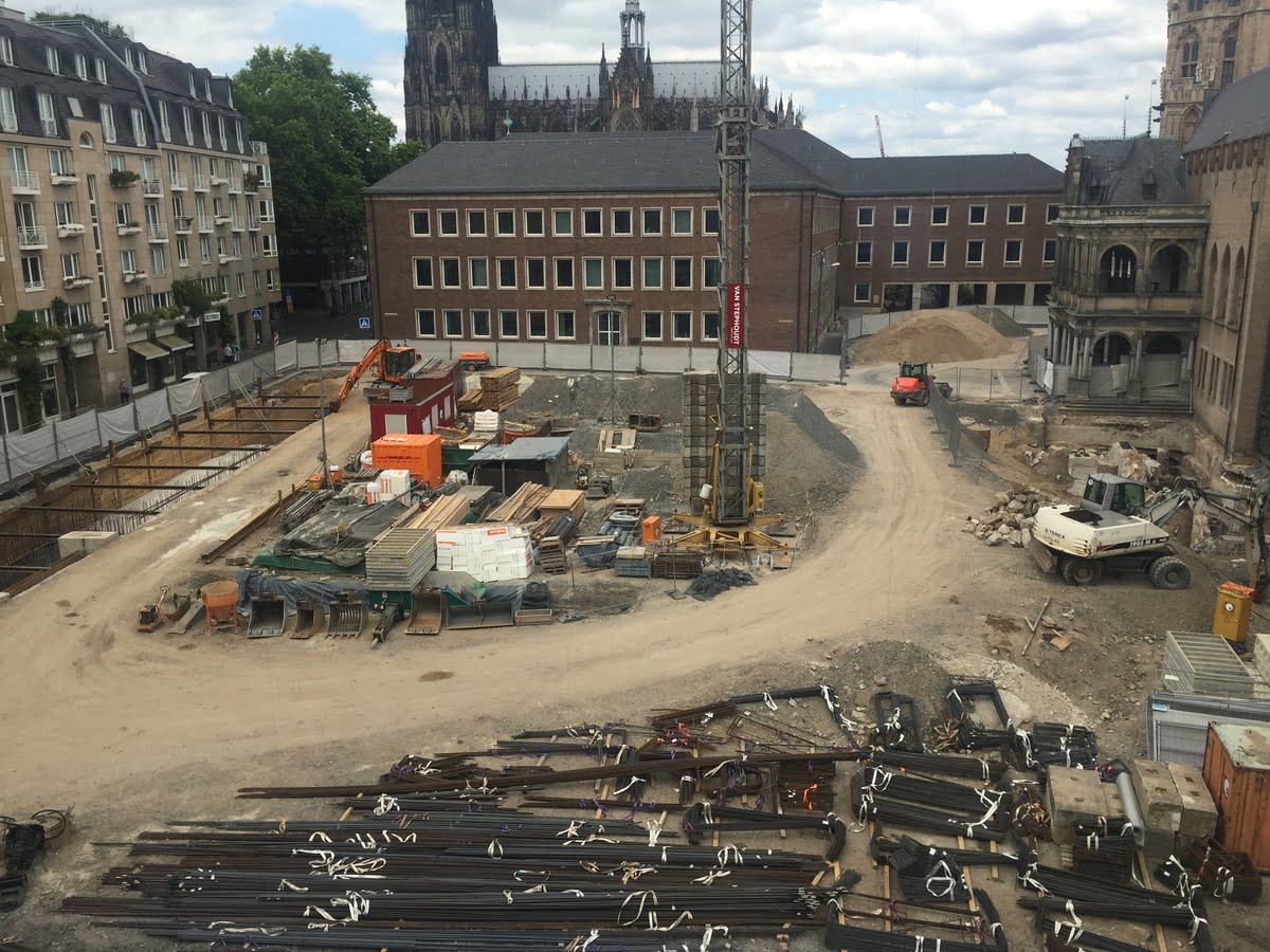
Applications of Construction Surveying
Construction surveying is a versatile field with a wide range of applications in the construction industry. It plays a crucial role in various stages of a construction project, from planning and design to construction and maintenance. Here are some key applications of construction surveying:
1. Site Analysis and Planning: Construction surveying is used during the site analysis and planning phase to gather data and assess the feasibility of a construction project. Surveyors conduct topographic surveys to map the existing terrain, vegetation, and structures. This information helps architects and engineers understand the site conditions and plan the project accordingly.
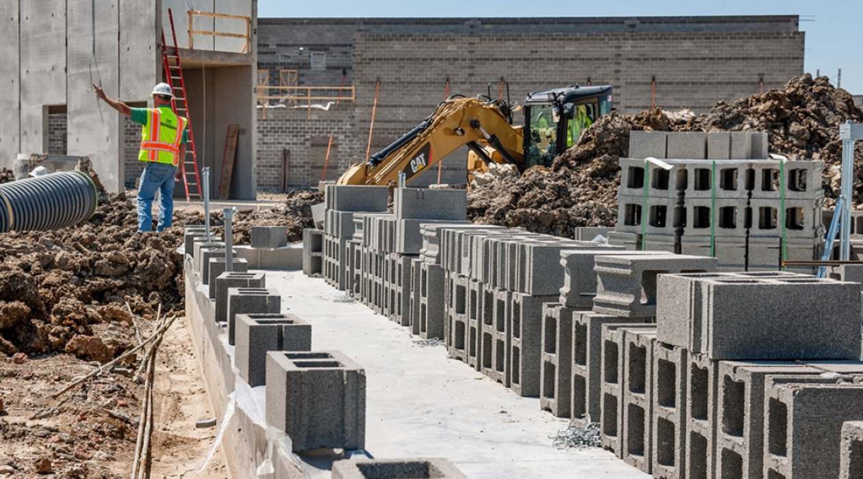
2. Design and Layout: Construction surveying plays a vital role in translating design plans into the physical world. Surveyors accurately position and stake out building boundaries, foundations, columns, walls, utilities, and other structures according to the design specifications. They ensure that the construction is aligned with the planned layout and dimensions.
3. Earthwork and Grading: Construction surveying is essential for earthwork and grading operations. Surveyors help determine the proper cut and fill slopes, as well as the required volume of earth to be excavated or added. They ensure that the site is properly prepared to support the construction of buildings, roads, and other infrastructure.
4. Stakeout and Layout: Construction surveyors are responsible for the stakeout and layout of various elements on the construction site. They accurately mark the positions of structures, utilities, and other project components according to the design plans. This ensures that the construction follows the intended layout and allows for efficient and precise construction activities.
5. Quality Control and Assurance: Construction surveying is crucial in quality control and assurance. Surveyors verify that construction work meets design specifications and building codes. They conduct inspections and measurements to ensure proper alignment, dimensions, and levels of structures. This helps eliminate errors and deviations during the construction process.
6. As-Built Documentation: Construction surveyors create as-built documentation, which records the final positions and dimensions of structures after construction is completed. This documentation provides accurate information for future reference, maintenance, and remodeling. It allows for proper documentation of changes or discrepancies that occurred during the construction process.
7. Monitoring and Deformation Analysis: Construction surveying is employed for monitoring the stability and deformation of structures during and after construction. Surveyors use advanced monitoring techniques to detect any unexpected movements or changes in the structures. This helps identify potential issues and allows for timely corrective action.
8. Legal and Dispute Resolution: Construction surveying plays a role in legal matters and dispute resolution. Accurate survey data and documentation can be used as evidence in cases involving property boundaries, construction disputes, or insurance claims. Surveyors may also provide expert opinions or testimony in legal proceedings.
Overall, construction surveying is integral to various aspects of a construction project. It ensures that construction activities align with design plans, maintains quality control, provides accurate documentation, and assists in resolving legal matters. The applications of construction surveying contribute to the successful and efficient completion of construction projects while ensuring compliance with regulations and industry standards.
Challenges in Construction Surveying
Despite its importance in construction projects, construction surveying involves several challenges that can impact the accuracy and efficiency of the surveying process. These challenges arise due to various factors, including site conditions, technology limitations, and human factors. Here are some of the common challenges faced in construction surveying:
1. Complex Site Conditions: Construction sites can have complex terrains, including steep slopes, dense vegetation, or bodies of water. These conditions can make it challenging to access certain areas or establish control points. Surveyors may need to employ specialized techniques or equipment to overcome these challenges and obtain accurate measurements.
2. Accuracy and Precision: Construction surveying requires a high level of accuracy and precision. Even slight errors in measurements or discrepancies in positioning can have significant consequences on the construction process and final structure. Surveyors must be diligent in ensuring accurate measurements and aligning structures precisely with design plans.
3. Technology Limitations: While surveying technology has advanced significantly, there are still limitations that can pose challenges. Equipment malfunctions, signal interference, and limited range can impact the accuracy and efficiency of data collection. Surveyors need to stay updated with the latest technology, employ proper calibration and maintenance practices, and have contingency plans to address any technological limitations.
4. Working in Dynamic Environments: Construction sites are dynamic environments where changes occur frequently. New structures are built, existing structures are demolished, and site conditions may change. Surveyors need to adapt to these changes and ensure that their measurements and layout accurately reflect the current state of the construction site.
5. Time Constraints: Construction projects often operate on tight schedules, and surveying activities need to be completed within specific timeframes. Surveyors face the challenge of balancing the need for accurate data collection with project deadlines. They must work efficiently while maintaining the required level of accuracy to avoid delays in the construction process.
6. Coordination and Communication: Construction surveyors need to collaborate closely with various stakeholders, including architects, engineers, contractors, and subcontractors. Effective coordination and communication are crucial to ensure that everyone is aligned with the surveying requirements and the overall project objectives. Miscommunication or lack of coordination can lead to errors or inconsistencies in the surveying process.
7. Safety Risks: Construction sites can pose safety risks to surveyors due to the presence of heavy machinery, materials, and high elevations. Surveyors must adhere to strict safety precautions and protocols to protect themselves and others on-site. They need to be aware of potential hazards and take necessary precautions to minimize risks.
8. Data Management and Integration: Construction surveying generates large amounts of data that need to be managed properly. Surveyors must ensure data integrity, organize and store data effectively, and integrate surveying data with other project data, such as design plans and construction documents. Efficient data management enhances communication, decision-making, and collaboration among project stakeholders.
Despite these challenges, experienced construction surveyors with in-depth knowledge, expertise, and effective problem-solving skills can overcome these obstacles. By employing sound surveying practices, staying updated with technology advancements, and communicating effectively with project teams, surveyors can mitigate challenges and ensure successful construction surveying outcomes.
Read more: What Is A Plumb Bob Used For In Surveying
Future Trends in Construction Surveying
The field of construction surveying is constantly evolving, driven by advancements in technology and an increasing demand for efficiency, accuracy, and sustainability in the construction industry. Here are some key future trends that are likely to shape the field of construction surveying:
1. Utilization of Robotics and Automation: Robotics and automation are expected to play a more significant role in construction surveying. Robotic total stations and autonomous surveying drones can expedite data collection, reduce human error, and improve overall efficiency. These technologies have the potential to automate repetitive surveying tasks and provide real-time data in a more streamlined manner.
2. Integration of Building Information Modeling (BIM): Building Information Modeling (BIM) is increasingly being adopted in construction projects. Construction surveyors will play a critical role in integrating surveying data with BIM to create accurate and comprehensive digital representations of the built environment. This integration allows for better collaboration among project stakeholders, improved design accuracy, and enhanced visualization of construction progress.
3. Advancements in Remote Sensing: Remote sensing technologies, such as LiDAR (Light Detection and Ranging) and aerial imagery, are becoming more sophisticated and affordable. These technologies enable construction surveyors to gather highly detailed and accurate data about construction sites from a distance. The use of remote sensing will continue to increase, providing comprehensive and up-to-date information for surveying and monitoring purposes.
4. Augmented Reality (AR) and Virtual Reality (VR): AR and VR technologies have the potential to revolutionize the way construction surveying is conducted. These technologies can provide immersive experiences, allowing surveyors to visualize and interact with surveying data in a virtual or augmented environment. This will enhance surveying accuracy, improve communication among stakeholders, and facilitate design and decision-making processes.
5. Enhanced Data Integration and Analysis: The future of construction surveying lies in the integration and analysis of data from various sources. Construction surveyors will need to adopt advanced data management tools and techniques to handle large volumes of data efficiently. This includes integrating surveying data with other project data, such as environmental data, geospatial data, and sensor data, to gain valuable insights for improved decision-making.
6. Sustainable Surveying Practices: Sustainable construction practices are gaining traction, and surveying is no exception. In the future, construction surveyors will need to focus on sustainable surveying practices, incorporating principles of green design, energy efficiency, and environmental preservation. They will play a crucial role in identifying and implementing sustainable solutions, such as optimizing site grading to minimize earthworks or suggesting sustainable materials and construction techniques.
7. Collaboration and Stakeholder Engagement: Collaboration and stakeholder engagement will continue to be vital in construction surveying. The future will see construction surveyors working more closely with architects, engineers, contractors, and other stakeholders, using collaborative platforms and tools to share and exchange surveying data in real-time. This will improve communication, enhance project coordination, and reduce errors and conflicts.
The future of construction surveying is exciting, marked by technological advancements and a focus on sustainability and efficiency. By embracing these future trends, construction surveyors can adapt to the changing landscape and continue to provide accurate, reliable, and valuable surveying data to support the successful implementation of construction projects.
Conclusion
Construction surveying is a critical element in the building and construction industry. It plays a pivotal role in ensuring accurate measurements, precise positioning, and proper alignment of structures within a construction site. By utilizing advanced surveying tools, techniques, and technology, construction surveyors provide architects, engineers, and contractors with accurate data that is essential for successful planning, design, and execution of construction projects.
Throughout this article, we have explored the definition of construction surveying and its importance in the construction industry. We have discussed the role of construction surveyors in collecting and analyzing data, establishing control points, and accurately placing structures. The process of construction surveying, involving site analysis, control point establishment, layout and marking, monitoring progress, and final verification, has been examined in detail. Additionally, we have highlighted the tools, techniques, and methods used in construction surveying, as well as its applications in various stages of the construction project.
While construction surveying is crucial for the successful completion of construction projects, it does come with challenges. Complex site conditions, accuracy and precision requirements, technology limitations, time constraints, and the need for coordination and communication pose challenges that surveyors need to overcome. However, with their expertise, problem-solving skills, and continuous adaptation to advancements in technology, construction surveyors can address these challenges and ensure accurate and efficient surveying outcomes.
The future of construction surveying looks promising, with trends such as robotics and automation, integration of BIM, advancements in remote sensing, augmented reality and virtual reality, enhanced data integration and analysis, sustainable practices, and increased collaboration and stakeholder engagement. These trends will pave the way for more efficient, accurate, and sustainable construction surveying processes, further enhancing the construction industry as a whole.
In conclusion, construction surveying is an indispensable component of the construction industry. It provides the foundation for accurate design implementation, quality control, and adherence to regulations. Construction surveyors play a crucial role in ensuring that construction projects are executed accurately and efficiently, resulting in safe and visually appealing structures. By embracing technological advancements, adopting sustainable practices, and engaging in effective collaboration, construction surveyors will continue to drive innovation and contribute to the successful completion of construction projects in the future.
Frequently Asked Questions about What Is Construction Surveying
Was this page helpful?
At Storables.com, we guarantee accurate and reliable information. Our content, validated by Expert Board Contributors, is crafted following stringent Editorial Policies. We're committed to providing you with well-researched, expert-backed insights for all your informational needs.


0 thoughts on “What Is Construction Surveying”