Home>diy>Planning & Engineering>What Is Surveying In Civil Engineering


Planning & Engineering
What Is Surveying In Civil Engineering
Modified: January 9, 2024
Learn about the importance of surveying in civil engineering and its role in the planning and engineering processes. Gain insights into the techniques and tools used for accurate measurement and analysis.
(Many of the links in this article redirect to a specific reviewed product. Your purchase of these products through affiliate links helps to generate commission for Storables.com, at no extra cost. Learn more)
Introduction
Welcome to the fascinating world of surveying in civil engineering! Surveying is an essential discipline that plays a crucial role in a wide range of civil engineering projects. From designing roads and bridges to constructing buildings and infrastructure, surveying provides the foundation for accurate and precise measurements in determining the physical characteristics of the Earth’s surface. This comprehensive article will delve into the definition of surveying, its importance in civil engineering, the principles and techniques involved, as well as the instruments and equipment used in the field.
Surveying can be defined as the science, art, and technology of accurately measuring and representing the three-dimensional characteristics of the Earth’s surface and its subsurface features. It involves the collection, analysis, and interpretation of spatial data using various surveying techniques and tools.
The importance of surveying in civil engineering cannot be overstated. It serves as the fundamental groundwork for the planning, designing, and construction of infrastructure projects. Civil engineers rely on surveying to collect crucial data about the topography, elevation, and features of a site, which is then used to create detailed maps, plans, and models. Without accurate surveying, it would be nearly impossible to ensure the safety, efficiency, and functionality of engineering projects.
The principles of surveying are based on mathematical calculations, geometric principles, and the use of specialized instruments. These principles ensure precision and accuracy in the measurements and enable engineers to create reliable surveying data. The principles include concepts such as triangulation, traverse, leveling, and geodetic surveying. Understanding these principles is essential for surveyors to carry out their work effectively.
There are various types of surveying techniques employed in civil engineering. These techniques can be broadly classified into two categories: terrestrial surveying and aerial surveying. Terrestrial surveying involves the use of instruments on the ground to collect measurements, while aerial surveying utilizes remote sensing technologies such as satellites, drones, and LiDAR (Light Detection and Ranging). Each technique has its own advantages and applications, and a skilled surveyor knows when and how to employ them effectively.
Key Takeaways:
- Surveying is the backbone of civil engineering, providing accurate measurements for site selection, topographic mapping, construction layout, and boundary determination. It ensures the success and sustainability of infrastructure projects.
- Despite challenges such as environmental factors and instrument limitations, surveyors play a crucial role in overcoming obstacles and ensuring the accuracy, reliability, and efficiency of surveying data. Their expertise is essential for the future of civil engineering projects.
Read more: What Is A Civil Engineering Technician
Definition of Surveying
Surveying is the practice of accurately measuring and mapping the Earth’s surface and its features. It involves the collection of data using specialized instruments and techniques to determine precise measurements of distances, angles, elevations, and coordinates. This information is then utilized to create maps, plans, and models that are crucial for civil engineering projects.
The primary objective of surveying is to establish the spatial relationships between different points on the Earth’s surface. By doing so, surveyors can create a detailed representation of the terrain, including its physical features, contours, and boundaries. Surveying is not limited to only horizontal measurements; it also includes vertical measurements that help determine the elevation of points relative to a reference datum.
To carry out accurate surveying, surveyors must consider several factors, such as the curvature of the Earth, magnetic variations, atmospheric conditions, and the accuracy of the instruments used. They must apply mathematical calculations and principles to ensure precise measurements and mitigate errors.
Surveying can be further divided into different disciplines, including land surveying, hydrographic surveying, geodetic surveying, and construction surveying. Each discipline has its own specific applications and techniques, but they all share the common goal of collecting and analyzing spatial data.
Land surveying is perhaps the most well-known branch of surveying and involves measuring and mapping the Earth’s surface to define property boundaries, establish land ownership, and assist in land development projects. Hydrographic surveying focuses on the measurement and mapping of bodies of water, such as rivers, lakes, and coastlines. This information is vital for navigation, coastal engineering, and environmental studies.
Geodetic surveying encompasses the measurement and study of the Earth’s shape, size, and gravitational field. This discipline involves highly accurate and precise measurements on a large scale, and it is necessary for creating global reference systems and mapping the Earth’s surface on a global scale.
Construction surveying, also known as engineering surveying, is concerned with the layout and positioning of structures and infrastructure during the construction process. It involves establishing reference points, marking boundaries, and providing accurate measurements for the successful implementation of construction plans.
In summary, surveying, in the context of civil engineering, is the scientific and technical process of measuring and mapping the Earth’s surface and its features. It is a critical discipline that provides the foundation for accurate planning, design, and construction in civil engineering projects.
Importance of Surveying in Civil Engineering
Surveying is an integral part of civil engineering, as it serves as the backbone for the successful implementation of infrastructure projects. Here are some key reasons why surveying holds immense importance in civil engineering:
- Site Selection and Planning: Surveying provides valuable information about the characteristics of a site, including its topography, boundaries, and existing features. This data is crucial for civil engineers when selecting suitable locations for construction projects, assessing the feasibility of development, and planning the layout of structures and infrastructure.
- Accurate Measurements: Surveying ensures precise measurements of distances, angles, elevations, and coordinates. These measurements are critical for creating accurate maps, plans, and models, which are essential for designing and constructing infrastructure projects with optimal accuracy and alignment.
- Mapping the Terrain: Surveyors create detailed terrain maps that provide information about the natural features, contours, and slopes of a site. This enables engineers to design structures that are in harmony with the existing landscape, taking advantage of the terrain and minimizing environmental impact.
- Boundary Establishment: Surveying plays a crucial role in defining the boundaries of properties, ensuring accurate land ownership records, and preventing disputes between landowners. By establishing clear boundaries, surveyors facilitate land development and construction projects without encroaching on neighboring properties.
- Infrastructure Design and Layout: Surveying provides the necessary data for engineers to design and lay out infrastructure elements such as roads, bridges, pipelines, and utilities. By accurately positioning these elements, surveyors ensure the efficient and safe movement of vehicles, pedestrians, and services.
- Construction Accuracy: During the construction phase, surveying is essential to ensure that structures are built according to the design specifications. Surveyors mark reference points, establish control networks, and monitor construction progress to ensure accuracy and adherence to the plans. This helps minimize errors and ensures that the project is built correctly and within tolerances.
- Geographic Information Systems (GIS): Surveying data forms the foundation for Geographic Information Systems, which are used in civil engineering for spatial analysis, asset management, and decision-making. GIS integrates surveying data with other geographical data, allowing engineers to make informed choices related to planning, maintenance, and infrastructure management.
Overall, surveying plays a critical role in civil engineering by providing accurate measurements, facilitating proper planning and design, and ensuring the successful implementation of construction projects. Without surveying, it would be challenging to achieve precision, efficiency, and safety in the built environment.
Principles of Surveying
The practice of surveying is built upon several fundamental principles that ensure accurate and reliable measurements. These principles form the basis for conducting surveys and are crucial for maintaining precision and consistency in surveying data. Here are some key principles of surveying:
- Accuracy: The principle of accuracy emphasizes the need for precise and reliable measurements. Surveyors must use high-quality instruments, employ proper techniques, and consider factors such as instrument errors, atmospheric conditions, and human errors. By ensuring accuracy, surveyors can confidently rely on surveying data for mapping, design, and construction purposes.
- Global Positioning System (GPS): The advent of GPS technology has revolutionized the field of surveying. GPS is a satellite-based system that provides real-time positioning information with high accuracy. The principle of GPS in surveying involves utilizing satellites to determine the precise coordinates of survey points on the Earth’s surface, enabling efficient and accurate positioning for a wide range of applications.
- Trigonometry and Geometry: Trigonometry and geometry are vital mathematical principles used in surveying. Trigonometry is used to measure angles and distances between survey points, while geometry helps in determining the size and shape of land areas. Surveyors use trigonometric calculations, such as triangulation and traverse, to accurately measure distances and angles and create a network of control points.
- Control Networks: Creating control networks establishes a framework of reference points that serve as a basis for all subsequent surveying activities. Control points are precisely measured and positioned, serving as a reference for mapping, boundary determination, and construction layout. This principle ensures consistent and accurate measurements throughout the surveying process.
- Levelling: Levelling is a principle used to determine the relative heights or elevations of different points on the Earth’s surface. It is essential for contour mapping, establishing gradients, and designing proper drainage systems. Levelling techniques involve the use of spirit levels, optical levels, and digital leveling instruments.
- Data Analysis and Adjustment: Surveyors analyze surveying data to determine if there are any discrepancies or errors. Data adjustments using statistical methods help in minimizing measurement errors and improving the overall accuracy of the survey. Adjustments can be made through methods such as least squares adjustment, which refines the measurements to produce the most accurate and consistent results.
- Legal and Ethical Considerations: Surveyors must adhere to legal and ethical standards when conducting surveys. They need to understand local land laws, property rights, and surveying regulations. Surveyors also have a responsibility to maintain the privacy and confidentiality of surveyed data and provide accurate and truthful information in their reports.
Understanding and applying these principles is essential for surveyors to carry out their work accurately and consistently. By adhering to these principles, surveying professionals can ensure that the data they collect is reliable, enabling successful engineering projects, land development, and infrastructure planning.
Types of Surveying Techniques
Surveying encompasses a range of techniques that are employed based on the specific requirements of a project. These techniques can be broadly classified into two categories: terrestrial surveying and aerial surveying. Let’s explore some of the commonly used types of surveying techniques:
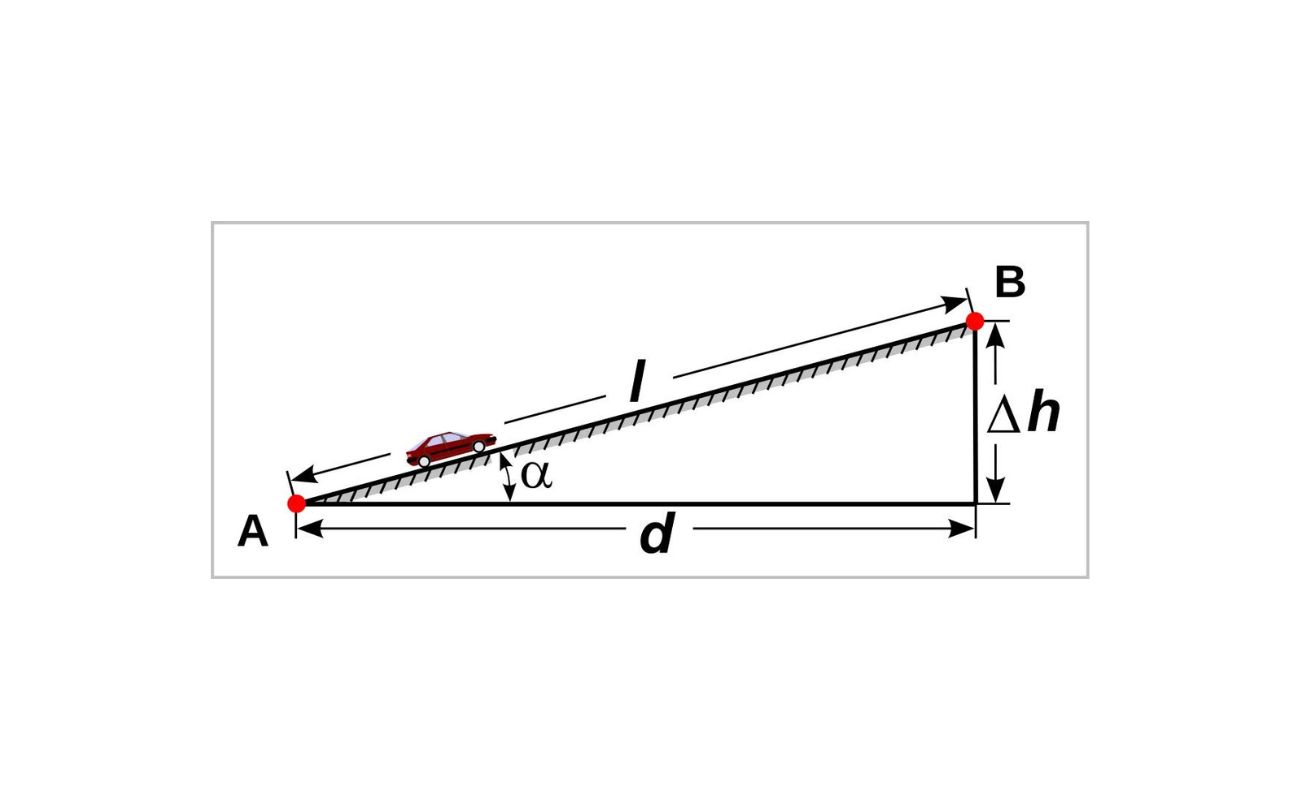
- Leveling: Leveling is a technique used to determine the relative heights or elevations of different points on the Earth’s surface. It involves the use of leveling instruments to measure the vertical distance between points. Leveling is crucial for creating accurate contour maps, designing drainage systems, and ensuring proper slope for construction projects.
- Triangulation: Triangulation is a technique that uses the principles of trigonometry to measure distances and angles between survey points. It involves forming a network of triangles by measuring the angles at each point and the lengths of the sides. Triangulation is useful for creating control networks to accurately determine the positions of survey points on the Earth’s surface.
- Traversing: Traversing is a method that involves a series of connected survey lines, in which the distances and angles between the points are measured. It is typically used for traversing large areas when accurate positions of multiple points need to be determined. Traversing is commonly employed in boundary surveys, road alignments, and engineering construction projects.
- Global Positioning System (GPS) Surveying: GPS surveying utilizes satellite-based positioning to determine accurate coordinates of survey points. GPS receivers receive signals from multiple satellites to calculate precise positions. This technique is widely used in various applications, including topographic mapping, geodetic surveying, and construction layout.
- Remote Sensing: Remote sensing involves collecting data about the Earth’s surface using sensors mounted on aircraft, satellites, or drones. Remote sensing techniques, such as aerial photography, LiDAR (Light Detection and Ranging), and satellite imagery, provide valuable information for terrain mapping, land cover classification, and environmental monitoring.
- Hydrographic Surveying: Hydrographic surveying focuses on measuring and mapping the features of bodies of water, including rivers, lakes, and coastlines. Techniques such as echo sounding, bathymetry, and side-scan sonar are used to determine water depths, locate submerged objects, and identify potential navigational hazards.
- Geodetic Surveying: Geodetic surveying involves precise measurements on a large scale to determine the size, shape, and gravitational field of the Earth. Geodetic surveyors use advanced techniques and equipment, such as very long baseline interferometry (VLBI) and satellite geodesy, to create geodetic networks and establish global reference systems.
- Boundary Surveying: Boundary surveying is carried out to establish the boundaries of a property or piece of land. It involves retracing and marking boundary lines, determining property corners, and resolving boundary disputes. This type of surveying requires thorough research of historical records, legal measurements, and land boundary laws.
Each surveying technique has its own advantages, applications, and limitations. Surveyors need to carefully assess the project requirements and select the appropriate technique(s) to ensure accurate and reliable surveying data.
Surveying in civil engineering is the process of measuring and mapping the earth’s surface to gather data for construction, mapping, and land development. It involves using specialized equipment and techniques to accurately determine the position, distance, and elevation of points on the land.
Read more: What Is Civil Engineering Major
Surveying Instruments and Equipment
Surveying instruments and equipment are essential tools used by surveyors to measure and collect data in the field. These instruments enable accurate and precise measurements, helping to ensure the reliability of surveying data. Let’s explore some of the commonly used surveying instruments and equipment:
- Total Station: A total station is a versatile instrument that combines an electronic theodolite, an electronic distance meter (EDM), and a data processing system. It is used for measuring angles, distances, and elevations between points, allowing for efficient and accurate surveying. Total stations often have features like electronic data storage, automatic target tracking, and remote data transfer capabilities.
- Theodolite: A theodolite is an optical instrument used to measure horizontal and vertical angles. It consists of a telescope mounted on a base with calibrated circles for precise angle measurements. Theodolites are often used for traversing, boundary surveys, and construction layout.
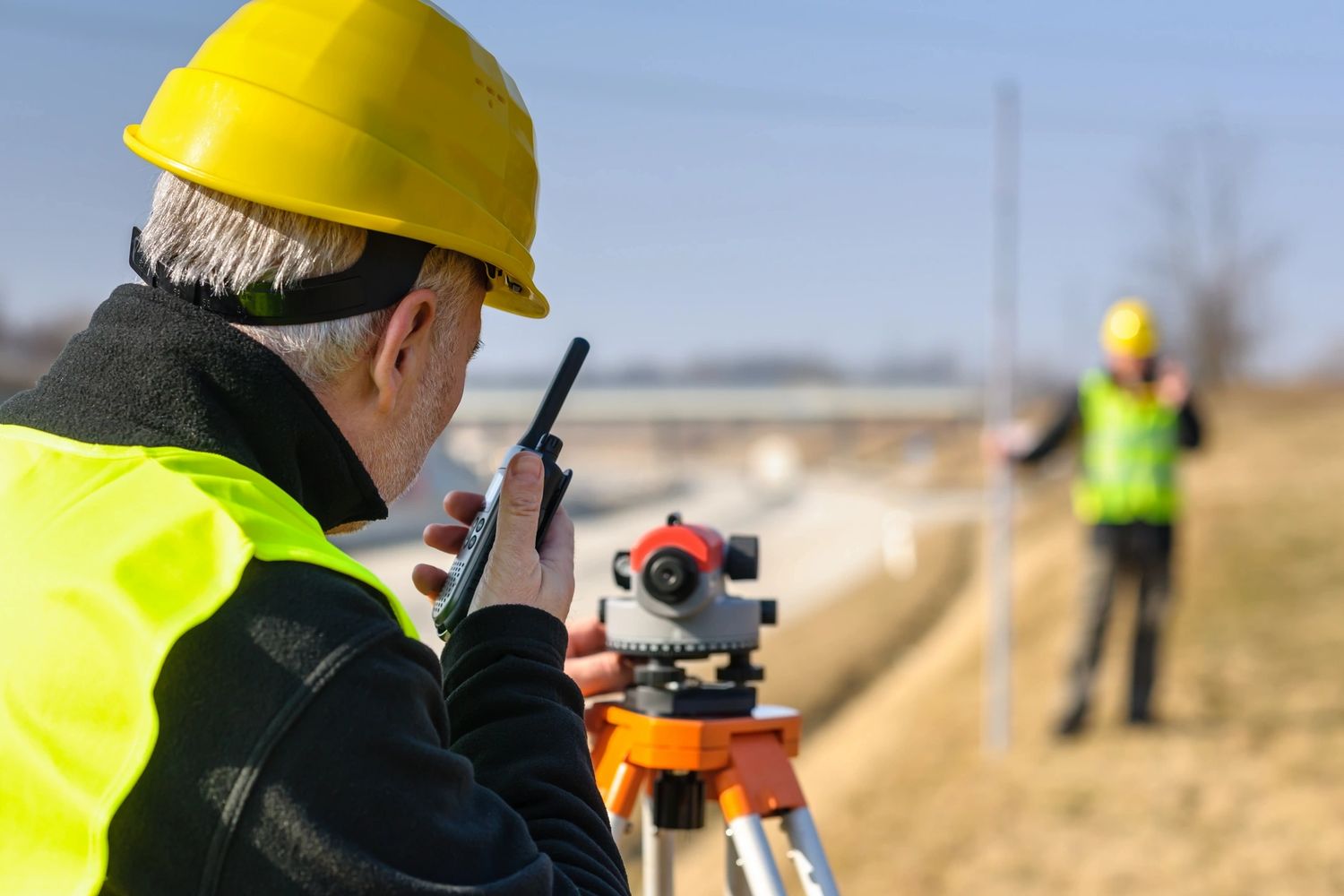
- Leveling Instrument: Leveling instruments, such as automatic levels, digital levels, and dumpy levels, are used to determine height differences or elevations between different points. These instruments employ a leveling bubble or a pendulum system to ensure the accuracy of the vertical measurements. Leveling instruments are essential for creating contour maps, establishing benchmarks, and monitoring construction site elevations.
- Global Positioning System (GPS) Receiver: GPS receivers utilize signals from satellites to determine accurate coordinates in three dimensions. They are widely used in surveying to establish control networks, collect accurate positioning data, and provide real-time navigation capabilities. GPS receivers range from handheld units for basic positioning to high-precision receivers used for geodetic surveying.
- Laser Scanners: Laser scanners, such as Terrestrial Laser Scanners (TLS) or Laser Imaging Detection and Ranging (LiDAR) systems, are used to collect precise 3D data of objects and environments. Laser scanners emit laser beams that bounce back from the objects, allowing for high-resolution point cloud data to be captured. Laser scanners are commonly used for detailed topographic surveys, as-built documentation, and structural monitoring.
- Prisms and Reflective Targets: Prisms and reflective targets are used in conjunction with total stations or theodolites to measure distances and angles. These targets reflect back the surveying instrument’s signals, allowing for accurate measurement of the distances and angles. Prisms and reflective targets are essential in situations where direct measurement to the object is not possible.
- Tape Measure and Ranging Poles: Tape measures are used for quick and simple measurements of distances in the field. Ranging poles are commonly used as reference points or targets for taking height measurements or aligning surveying instruments. These basic tools are still widely used due to their simplicity and portability.
- Surveying Accessories: Various accessories support the surveying process, including tripods, leveling staffs, data loggers, and surveying markers. Tripods provide stability for surveying instruments, leveling staffs are used to measure height differences, data loggers help record and store surveying data, and surveying markers, such as boundary markers, are used to mark specific points for future reference.
These surveying instruments and equipment play a crucial role in collecting accurate field measurements, enabling surveyors to create precise maps, plans, and models for civil engineering projects. Advancements in technology continue to bring more sophisticated and efficient instruments to the field of surveying, improving accuracy, productivity, and data analysis capabilities.
Surveying Field Procedures
Surveying field procedures involve a series of systematic steps that surveyors follow to collect accurate measurements and data in the field. These procedures ensure consistency, reliability, and efficiency in surveying operations. Let’s explore some of the common field procedures utilized in surveying:
- Planning and Reconnaissance: Before starting any surveying project, careful planning and reconnaissance are essential. Surveyors examine project requirements, review existing maps and data, identify survey control points, and determine the appropriate surveying techniques and equipment to be used. It is crucial to assess site conditions, accessibility, safety considerations, and potential obstacles or challenges.
- Ground Control Establishment: Establishing accurate ground control points is a critical step in surveying. Surveyors set up known control points on the ground, using permanent markers or temporary targets. These control points serve as reference points for measurements and enable the accurate positioning of other surveying instruments. The control points are often distributed strategically across the project site to ensure comprehensive coverage.
- Instrument Calibration: Before commencing measurements, surveying instruments must be properly calibrated. This involves checking and adjusting instruments for accurate readings. Calibration includes verifying the accuracy of angles, distances, and other measurements, ensuring that the instruments are functioning correctly, and compensating for any instrument errors if necessary.
- Point Measurement and Recording: Surveyors systematically measure and record the coordinates, angles, distances, and elevations of survey points according to the project requirements and surveying technique being used. Measurements can be collected using various instruments such as total stations, theodolites, GPS receivers, or laser scanners. It is crucial to adhere to standard measurement procedures, take multiple measurements for redundancy, and ensure accurate data recording.
- Data Processing and Analysis: Once field measurements are collected, surveyors conduct data processing and analysis to validate the accuracy and reliability of the measurements. This may involve adjusting the data, identifying and resolving any discrepancies or errors, and applying statistical methods to improve the overall precision of the surveying data. Software and specialized programs are often used for data processing and analysis to generate accurate maps, models, and reports.
- Quality Assurance and Quality Control: Throughout the surveying process, quality assurance and quality control measures are implemented to ensure the accuracy and reliability of the surveying data. This includes regular checks of instruments and equipment, comparing field measurements with control points, verifying the consistency of measurements, and conducting checks against existing data or legal requirements. Quality control measures help identify and rectify any errors or inconsistencies in the surveying data.
- Documentation and Reporting: After completing the fieldwork and data processing, surveyors prepare comprehensive documentation and reports that summarize the surveying activities and findings. This includes documenting the survey control points, measurement procedures, data analysis methodologies, and any relevant observations or notes. Reports typically include maps, plans, and other graphical representations, as well as detailed information regarding the surveyed areas.
By following these field procedures, surveyors ensure the accuracy, reliability, and consistency of surveying data. The careful planning, accurate measurements, and thorough data processing and analysis help facilitate the successful implementation of civil engineering projects based on reliable surveying data.
Applications of Surveying in Civil Engineering
Surveying is a critical component of civil engineering, as it finds wide-ranging applications in various stages of project development. Surveying plays a crucial role in planning, design, construction, and maintenance of civil engineering projects. Let’s explore some of the key applications of surveying in civil engineering:
- Site Investigation and Selection: Surveying is used to assess potential project sites, considering factors such as topography, soil conditions, drainage patterns, and existing infrastructure. The data collected during site investigations helps civil engineers determine the suitability and feasibility of a site for a specific project, such as building construction, road development, or utility installations.
- Topographic Mapping: Surveying provides accurate measurements of the Earth’s surface, allowing for the creation of topographic maps. Topographic maps depict natural and artificial features, including contours, vegetation, water bodies, and existing infrastructure. These maps are essential for civil engineers to understand the terrain, plan the alignment of roads, railways, and utilities, and assess the impact of the project on the surrounding environment.
- Construction Layout: Surveying plays a vital role in accurately laying out construction projects on the ground. Surveyors establish control points and reference lines to ensure that structures are built according to the design plans. Construction layout surveys help position foundations, columns, walls, and other elements precisely, ensuring accuracy, alignment, and compliance with engineering standards.
- Boundary Determination and Land Development: Surveying is used to establish property boundaries, resolve boundary disputes, and aid in land development. Boundary surveys involve retracing historical boundaries, creating accurate boundary lines, and marking property corners. This information assists in the proper division of land for residential, commercial, or industrial purposes.
- Volumetric Calculations: Surveying provides the ability to accurately calculate volumes of earthwork or materials during construction projects. By comparing the pre-construction and post-construction measurements of the surfaces, surveyors can determine the quantity of materials moved or the volume of excavations, enabling efficient planning and costing of projects.
- Utility and Infrastructure Design: Surveying is crucial in the design and layout of utility systems, such as water supply, sewerage, and electrical networks. Accurate survey data enables civil engineers to determine the optimal routes, depths, and alignments for these networks, ensuring efficient and effective distribution of infrastructure services.
- Monitoring and Maintenance: Surveying is employed for monitoring the stability and condition of structures, such as bridges, dams, and buildings. Surveyors conduct periodic measurements to assess any movement, settlement, or deformation in these structures over time. This information helps in planning maintenance and repair activities, ensuring the safety and longevity of civil engineering projects.
- Environmental Impact Assessment: Surveying assists in the evaluation and assessment of environmental impacts caused by civil engineering projects. By collecting data on the existing environmental conditions and features, surveyors can identify potential impacts, such as changes to water bodies, habitats, or vegetation. This information aids in designing mitigation measures and ensuring compliance with environmental regulations.
These applications highlight the importance of surveying in civil engineering. Surveying data serves as the foundation for decision-making, design, and construction processes, allowing engineers to accurately plan, execute, and manage their projects with efficiency and precision.
Challenges in Surveying
Surveying is a complex and precise field that poses several challenges to surveyors. These challenges can arise from various factors, including the environment, technology limitations, human errors, and project-specific requirements. Let’s explore some of the common challenges faced by surveyors:
- Environmental Factors: Surveyors must contend with various environmental conditions that can impact their work. Factors such as extreme weather conditions, dense vegetation, rugged terrains, and limited access to certain areas can affect the accuracy and efficiency of measurements. In some cases, adverse weather conditions may require surveyors to reschedule or delay fieldwork, leading to project delays.
- Instrument Limitations: Surveying instruments have inherent limitations that can impact measurement accuracy. Factors such as instrument errors, limited range, signal interference, and calibration uncertainties can introduce errors in the collected data. Surveyors must be aware of these limitations and take appropriate measures to minimize errors through regular calibration, proper usage, and quality control checks.
- Complex Terrain: Surveying projects in rugged or complex terrains, such as mountainous regions or dense urban areas, present unique challenges. The presence of steep slopes, irregular boundaries, and obstructed sightlines can make measurements more difficult and time-consuming. Surveyors may need to employ specialized techniques, such as remote sensing or ground-based scanning, to overcome these challenges.
- Data Integration and Analysis: Integrating and analyzing surveying data from different sources and formats can be challenging. Combining data collected through different techniques or instruments requires careful data integration and adjustment to ensure compatibility. Surveyors must possess the necessary software skills to process, analyze, and visualize the data effectively, ensuring the accuracy and reliability of the final results.
- Accuracy and Precision: Achieving high levels of accuracy and precision is essential in surveying, but it can be challenging due to various factors. Human errors in taking measurements, instrument limitations, atmospheric conditions, and natural variations in terrain can all impact the accuracy of surveying data. Surveyors must exercise caution and utilize appropriate measurement techniques, redundancy, and quality control measures to minimize errors and improve accuracy.
- Coordination and Communication: Large-scale surveying projects often involve multiple teams, each responsible for different aspects of the survey. Effective coordination and communication between these teams are crucial for ensuring consistency in measurement techniques, data collection, and analysis. Poor communication and lack of coordination can lead to inconsistencies and discrepancies in the collected data, which can complicate data integration and affect the overall accuracy of the project.
- Legal and Regulatory Compliance: Surveyors must navigate legal and regulatory requirements, including land use regulations, property rights, and local surveying regulations. Challenges can arise in obtaining necessary permits, dealing with property disputes, or working in areas with restricted access. Surveyors must stay up-to-date with relevant laws and regulations to ensure compliance and avoid legal complications.
- Data Privacy and Security: Surveying involves collecting large amounts of data, including sensitive information about properties and infrastructure. Ensuring data privacy and security is paramount to protect the confidentiality and integrity of the collected information. Surveyors must implement appropriate data management practices, secure storage systems, and adhere to privacy regulations to safeguard the surveying data.
Overcoming these challenges requires a combination of technical expertise, experience, careful planning, and implementation of quality control measures. Surveyors must stay updated with advancements in surveying technology and techniques and continuously improve their skills to tackle the ever-evolving challenges in the field of surveying.
Conclusion
Surveying is a vital discipline within civil engineering, providing the foundation for accurate measurements, reliable mapping, and informed decision-making. It plays a crucial role in the planning, design, construction, and maintenance of infrastructure projects. Through the use of precise instruments, advanced technology, and systematic field procedures, surveyors collect and analyze data to determine the spatial relationships between different points on the Earth’s surface.
This comprehensive article has explored the definition of surveying and its importance in civil engineering, highlighting its applications in site selection, topographic mapping, construction layout, boundary determination, and more. We have discussed the principles of surveying, including accuracy, GPS utilization, trigonometry, and control networks. Additionally, we explored common surveying techniques such as leveling, triangulation, GPS surveying, and remote sensing.
We also delved into the essential surveying instruments and equipment used in the field, including total stations, theodolites, GPS receivers, laser scanners, and prisms. Furthermore, we discussed the importance of following surveying field procedures, such as planning and reconnaissance, instrument calibration, data processing, and quality control.
While surveying provides numerous benefits, it also presents challenges such as environmental factors, instrument limitations, complex terrains, and obtaining accurate and precise measurements. Surveyors must overcome these challenges through careful planning, technical expertise, and adherence to industry standards.
In conclusion, the field of surveying is integral to the success of civil engineering projects. It lays the groundwork for accurate planning and design, ensures efficient construction, and facilitates the management and maintenance of infrastructure. By employing accurate measurements, advanced technology, and thorough analysis, surveyors contribute significantly to the safety, functionality, and sustainability of the built environment.
As technology continues to advance, surveying will evolve, enabling even more sophisticated data collection and analysis techniques. The future of surveying holds tremendous potential for enhancing the accuracy, efficiency, and sustainability of civil engineering projects, further solidifying its crucial role in the industry.
Frequently Asked Questions about What Is Surveying In Civil Engineering
Was this page helpful?
At Storables.com, we guarantee accurate and reliable information. Our content, validated by Expert Board Contributors, is crafted following stringent Editorial Policies. We're committed to providing you with well-researched, expert-backed insights for all your informational needs.








0 thoughts on “What Is Surveying In Civil Engineering”