Articles
What Is A Laser Level For Surveying
Modified: August 21, 2024
Learn about the importance of laser levels in surveying and how they assist in precise measurements. Browse our informative articles to gain valuable insights.
(Many of the links in this article redirect to a specific reviewed product. Your purchase of these products through affiliate links helps to generate commission for Storables.com, at no extra cost. Learn more)
Introduction
Welcome to the world of laser leveling in surveying! In the field of land surveying and construction, accuracy is everything. Precise measurements and level surfaces are crucial for achieving accurate results in various projects. This is where laser levels come into play.
A laser level is a tool that utilizes laser technology to create a reference line or plane that is completely level. It is widely used in the construction and surveying industries to ensure precise measurements and level surfaces.
In this article, we will delve deeper into the world of laser levels and explore their functionality, applications, benefits, and factors to consider when choosing the right laser level for surveying.
Key Takeaways:
- Laser levels revolutionize surveying with unmatched precision, time-saving efficiency, and versatile applications, ensuring accurate measurements and level surfaces for successful projects.
- When choosing a laser level, consider factors such as type, accuracy, self-leveling capability, visibility, durability, and budget to make an informed decision that meets specific surveying needs.
Read more: What Is Laser Level
What is a Laser Level?
A laser level is a specialized device used in surveying and construction to establish a straight and level reference line or plane. It operates based on the principle of using laser technology to project a visible or invisible laser beam onto a surface, creating a precise level line or plane.
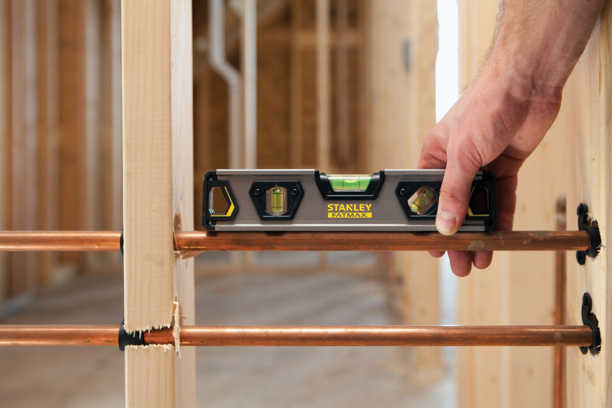
Unlike traditional leveling methods, which involve the use of bubble levels or spirit levels, laser levels offer a higher level of accuracy, efficiency, and convenience. They provide a consistent reference point that can be easily seen and followed, making them invaluable tools in a variety of surveying applications.
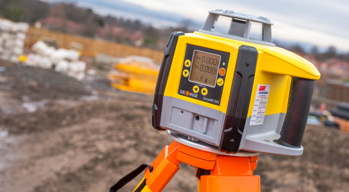
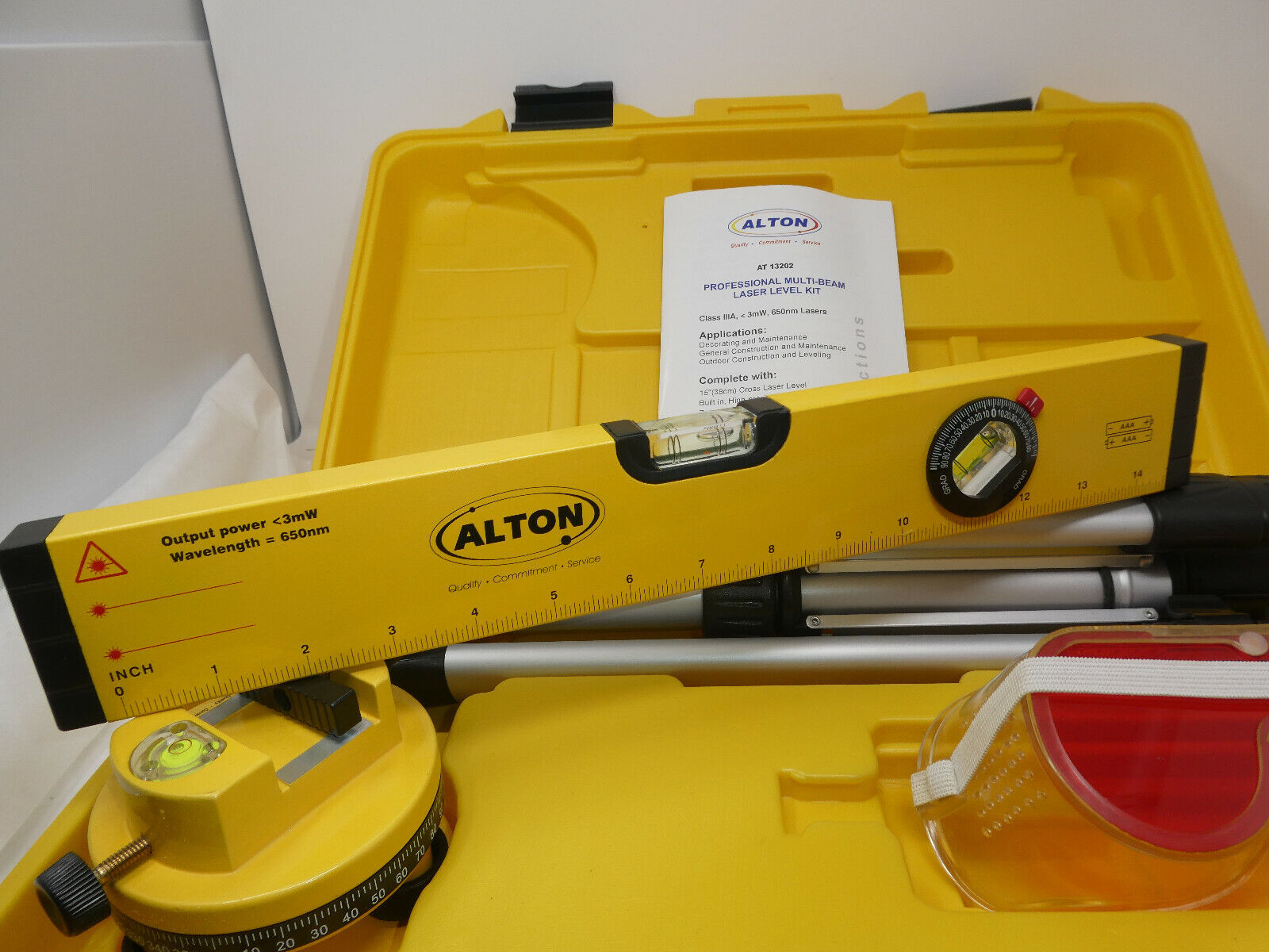
Laser levels come in different types and designs, each catering to specific needs. The most common types include rotary laser levels, line laser levels, and dot laser levels.
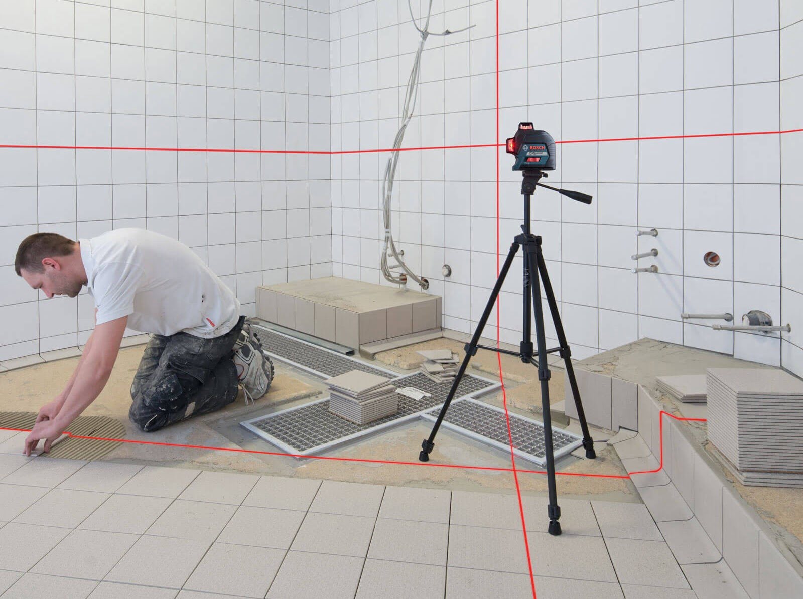
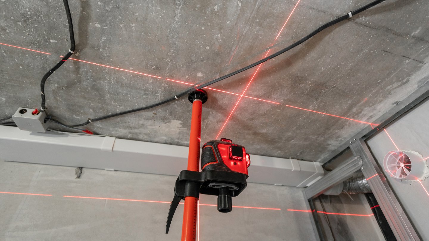
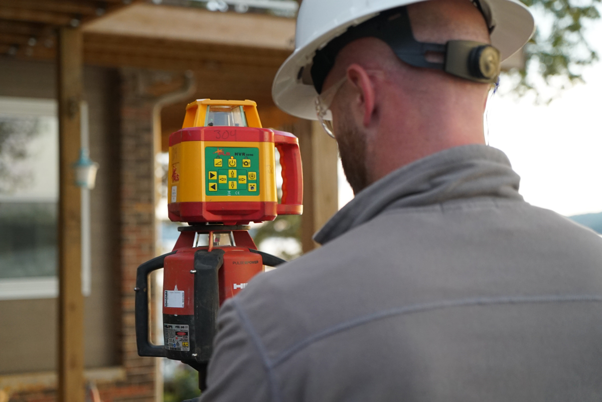
Rotary laser levels emit a rotating laser beam in a 360-degree radius, creating a level reference plane that can be seen all around. These are commonly used for large-scale outdoor projects or when a level line needs to be established over a long distance.
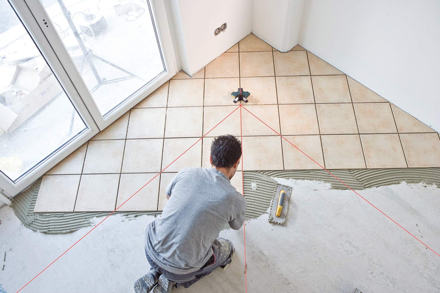
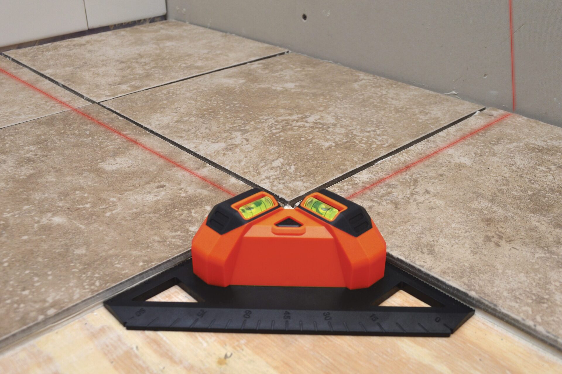
Line laser levels, on the other hand, project a straight vertical or horizontal laser line onto a surface. These are primarily used for indoor applications such as aligning cabinets, installing tiles, or mounting pictures. Line laser levels are often preferred for their portability and ease of use.
Dot laser levels emit multiple laser dots onto a surface, allowing for precise positioning of points. They are commonly used in applications such as plumbing, electrical work, and HVAC installation.
Overall, laser levels are essential tools in surveying and construction, enabling professionals to achieve accurate measurements, level surfaces, and consistent results. Their versatility and accuracy make them indispensable in a wide range of projects.
How Does a Laser Level Work?
A laser level works by utilizing laser technology to generate a straight and level reference line or plane. It consists of several components that work together to create the laser beam and ensure its accuracy.
The main components of a laser level include a laser diode, a rotating prism or mirror (in the case of rotary laser levels), leveling mechanisms, and control buttons or knobs.
When a laser level is turned on, the laser diode inside the device emits a laser beam. The laser beam passes through a prism or mirror that rotates at a high speed in the case of rotary laser levels, or through an optical system in the case of line and dot laser levels.
The rotating prism or mirror, or the optical system, then directs the laser beam to create a level line or plane by projecting it onto a surface. The laser beam can be visible or invisible, depending on the type of laser level.
To ensure accuracy, laser levels are equipped with built-in leveling mechanisms. These mechanisms utilize a pendulum or electronic sensor system to detect and maintain a level position. If the device is not level, the leveling mechanism adjusts the position of the laser beam accordingly to maintain its level reference line or plane.
In addition to the leveling mechanisms, laser levels usually have control buttons or knobs to adjust the beam’s visibility, brightness, rotation speed (in the case of rotary laser levels), and other settings. These controls allow the user to customize the laser level’s output to suit the specific requirements of the project.
It is important to note that laser levels require a stable base or mount to ensure accurate results. They are typically mounted on tripods or attached to brackets or wall mounts for stability. Some laser levels also come with self-leveling features, which automatically ensure a level position without the need for manual adjustments.
Overall, laser levels work by utilizing laser technology, rotating prisms or mirrors, leveling mechanisms, and control buttons to create a straight and level reference line or plane. Their precise operation and versatility make them essential tools in surveying and construction.
Applications of Laser Levels in Surveying
Laser levels have revolutionized the field of surveying, offering numerous applications and benefits. Here are some of the key applications of laser levels in surveying:
- Establishing Ground Control Points: Laser levels are used to establish precise ground control points (GCPs) in surveying projects. GCPs are reference points on the ground that help in accurately mapping and measuring the area of interest. By projecting a level reference line or plane, laser levels enable surveyors to set up GCPs with high accuracy and consistency.
- Topographic Surveying: Laser levels play a crucial role in topographic surveying, which involves mapping the natural and man-made features of a land. Surveyors use laser levels to establish benchmark elevations, create level contours, and measure height differences across the surveyed area. This accurate and precise data is essential for various engineering and construction projects.
- Construction Layout: Laser levels are indispensable for laying out precise and level lines during construction projects. Surveyors use laser levels to mark the edges of buildings, roads, and other structures, ensuring accurate alignment and dimensions. This reduces errors and allows for precise construction based on the established lines.
- Alignment and Leveling of Structures: Laser levels are used to align and level structures such as buildings, bridges, and pipelines. By projecting a level reference line or plane, surveyors can ensure that the structure is straight and perfectly aligned. This is crucial for maintaining structural integrity and preventing any issues in the long run.
- Land Grading and Earthwork: Laser levels are employed in land grading and earthwork projects to create level surfaces and accurately measure cut and fill volumes. Surveyors use laser levels to set up grade stakes, allowing contractors to achieve the desired level of land grading and earthwork operations.
- Utility and Infrastructure Mapping: Laser levels are used to map utility lines and infrastructure, such as water and sewer lines, electrical conduits, and telecommunication lines. By projecting level lines, surveyors can accurately determine the depth and position of these vital systems, preventing conflicts and ensuring proper placement during construction projects.
- Monitoring and Deformation Analysis: Laser levels are applied in monitoring structures and analyzing deformations over time. By periodically measuring the change in elevations or angles at specific points, surveyors can detect any movement or deformation in structures, ensuring early detection of potential issues and implementing necessary remedial actions.
These are just a few examples of the wide range of applications for laser levels in surveying. Their precision, ease of use, and versatility make them invaluable tools for collecting accurate data and ensuring successful surveying outcomes.
When using a laser level for surveying, always ensure that the device is properly calibrated and set up on a stable surface to ensure accurate and reliable measurements.
Benefits of Using Laser Levels in Surveying
Using laser levels in surveying offers numerous benefits that significantly enhance the accuracy, efficiency, and overall quality of surveying projects. Here are some of the key benefits of using laser levels:
- Precision: Laser levels provide unparalleled precision in establishing level reference lines and planes. They offer consistent and accurate measurements, ensuring that surveying data is reliable and precise.
- Time Saving: Laser levels enable surveyors to work more efficiently by rapidly establishing level lines or planes. This saves time compared to traditional leveling methods, such as using bubble levels or spirit levels, which can be time-consuming and less accurate.
- Ease of Use: Laser levels are user-friendly and straightforward to operate. With simple controls and clear visibility of the laser beam, they can be easily set up and used by both experienced surveyors and beginners.
- Enhanced Visibility: Laser levels offer high visibility of the projected laser beam, even in bright sunlight or low-light conditions. This allows surveyors to easily see and follow the reference line or plane, ensuring accurate measurements and alignment.
- Increased Efficiency: Laser levels enable surveyors to work at a faster pace, thanks to their quick and accurate leveling capabilities. This increases overall project efficiency and productivity, allowing more tasks to be completed within a given timeframe.
- Consistency: Laser levels provide consistent results across different surveying tasks. The level reference line or plane remains constant, eliminating potential errors and inconsistencies that can arise with manual leveling methods.
- Remote Control Functionality: Many laser levels come with remote control features, allowing surveyors to operate the device from a distance. This is particularly useful when working on large-scale projects or in hazardous environments where direct access to the laser level may be restricted.
- Adaptability: Laser levels can be utilized in a variety of surveying applications, making them versatile tools. They can be used for establishing ground control points, construction layout, topographic surveying, infrastructure mapping, and much more.
- Improved Safety: Laser levels contribute to a safer work environment by reducing the need for surveyors to physically reach difficult or hazardous locations. This minimizes the risk of accidents and injuries during surveying operations.
- Data Integration: Laser levels can be integrated with other surveying equipment and software, allowing for seamless data transfer and analysis. This streamlines the surveying process and facilitates better collaboration among surveying teams.
Overall, the benefits of using laser levels in surveying are undeniable. Their precision, time-saving capabilities, ease of use, increased efficiency, and adaptability make them indispensable tools for surveyors, delivering accurate results and ensuring the success of surveying projects.
Read more: What Is The Best Laser Level
Factors to Consider When Choosing a Laser Level
When selecting a laser level for surveying, it is important to consider several factors to ensure that you choose the right tool for your specific requirements. Here are some key factors to consider when choosing a laser level:
- Type of Laser Level: Determine the type of laser level that best suits your needs. Consider factors such as the distance of measurement, indoor or outdoor use, and the specific applications you will be using the laser level for. Rotary laser levels are ideal for large-scale outdoor projects, while line laser levels are more suitable for indoor applications.
- Accuracy and Range: Look for a laser level with high accuracy and a suitable range for your surveying tasks. Consider the required precision for your projects and choose a laser level that meets your accuracy requirements. Also, ensure that the range of the laser level is sufficient for the distances you need to cover.
- Self-Leveling Capability: Determine if you need a laser level with self-leveling capabilities. Self-leveling laser levels automatically adjust their position to maintain a level reference line or plane, saving time and ensuring accuracy. This feature is particularly useful for surveying tasks that require frequent adjustments or when working on uneven terrain.
- Visibility: Consider the visibility of the laser beam in different lighting conditions. If you anticipate working in bright sunlight or low-light conditions, choose a laser level with a brighter, more visible laser beam to ensure accurate measurements and alignment.
- Durability and Construction: Look for a laser level that is built to withstand the demands of surveying work. Opt for a sturdy and durable construction that can handle rough conditions and potential drops. Ensure that the laser level is water-resistant or waterproof if you anticipate working in wet or harsh environments.
- Battery Life: Check the battery life of the laser level, particularly if you will be using it for extended periods. A longer battery life ensures uninterrupted use, reducing the need for frequent battery changes or recharging.
- Mounting Options: Consider the mounting options available for the laser level. Look for a laser level that is compatible with various mounting options such as tripods, brackets, or wall mounts. This allows for flexibility in setting up the laser level securely and at the desired height.
- Budget: Determine your budget for a laser level and find one that fits within your price range. Consider the features and capabilities that are essential for your surveying tasks, and prioritize those when comparing prices.
- Brand and Warranty: Choose a reliable brand that is known for manufacturing high-quality laser levels. Research the reputation of different brands and consider the warranty offered with the laser level. A good warranty provides peace of mind and ensures long-term support if any issues arise with the laser level.
By considering these factors and evaluating your specific surveying needs, you can make an informed decision when choosing a laser level. Remember to weigh the importance of each factor and prioritize those that are most critical for the success of your surveying projects.
Conclusion
Laser levels have become indispensable tools in the field of surveying, offering unmatched precision, efficiency, and convenience. As we have explored in this article, laser levels play a crucial role in establishing level reference lines or planes, allowing for accurate measurements, level surfaces, and consistent results.
Whether you are working on topographic surveying, construction layout, land grading, or infrastructure mapping, laser levels provide the accuracy and reliability needed to ensure the success of your surveying projects.
From their ease of use and enhanced visibility to their time-saving capabilities and adaptability, laser levels offer a range of benefits that make them essential tools for surveyors. Their precision and level of accuracy surpass traditional leveling methods, improving the quality and efficiency of surveying operations.
When selecting a laser level, it is crucial to consider factors such as the type of laser level, accuracy and range, self-leveling capability, visibility, durability, battery life, mounting options, budget, and brand reputation. By taking these factors into account, you can choose the right laser level that meets your specific surveying needs.
In conclusion, laser levels have revolutionized the surveying industry, providing surveyors with the tools necessary to achieve accurate measurements, level surfaces, and consistent results. With their advanced technology and user-friendly design, laser levels have become essential companions for surveyors, enabling them to tackle a wide range of surveying tasks with confidence and precision.
So, embrace the power of laser leveling in your surveying endeavors and experience the immense benefits these tools bring to your projects. With a laser level in hand, you can elevate your surveying capabilities and achieve new levels of accuracy and efficiency.
Frequently Asked Questions about What Is A Laser Level For Surveying
Was this page helpful?
At Storables.com, we guarantee accurate and reliable information. Our content, validated by Expert Board Contributors, is crafted following stringent Editorial Policies. We're committed to providing you with well-researched, expert-backed insights for all your informational needs.


0 thoughts on “What Is A Laser Level For Surveying”